 23 |
23 | 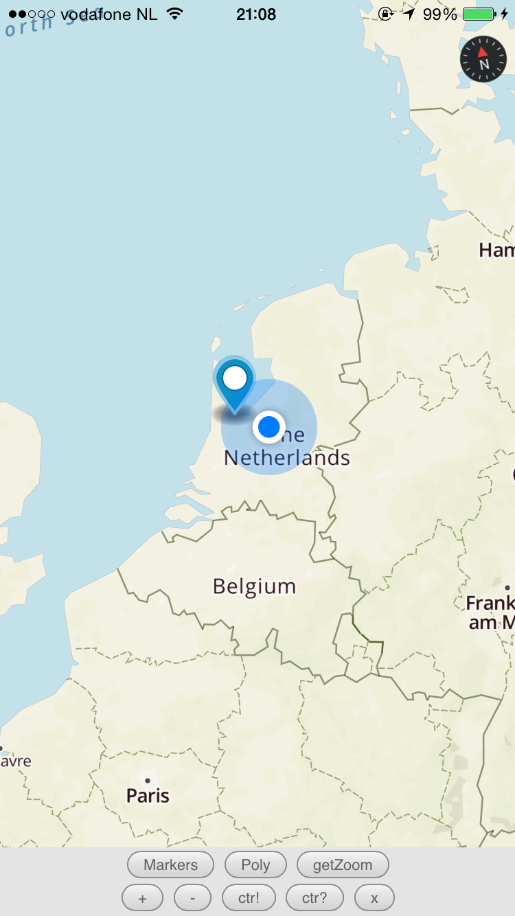 24 |
24 | 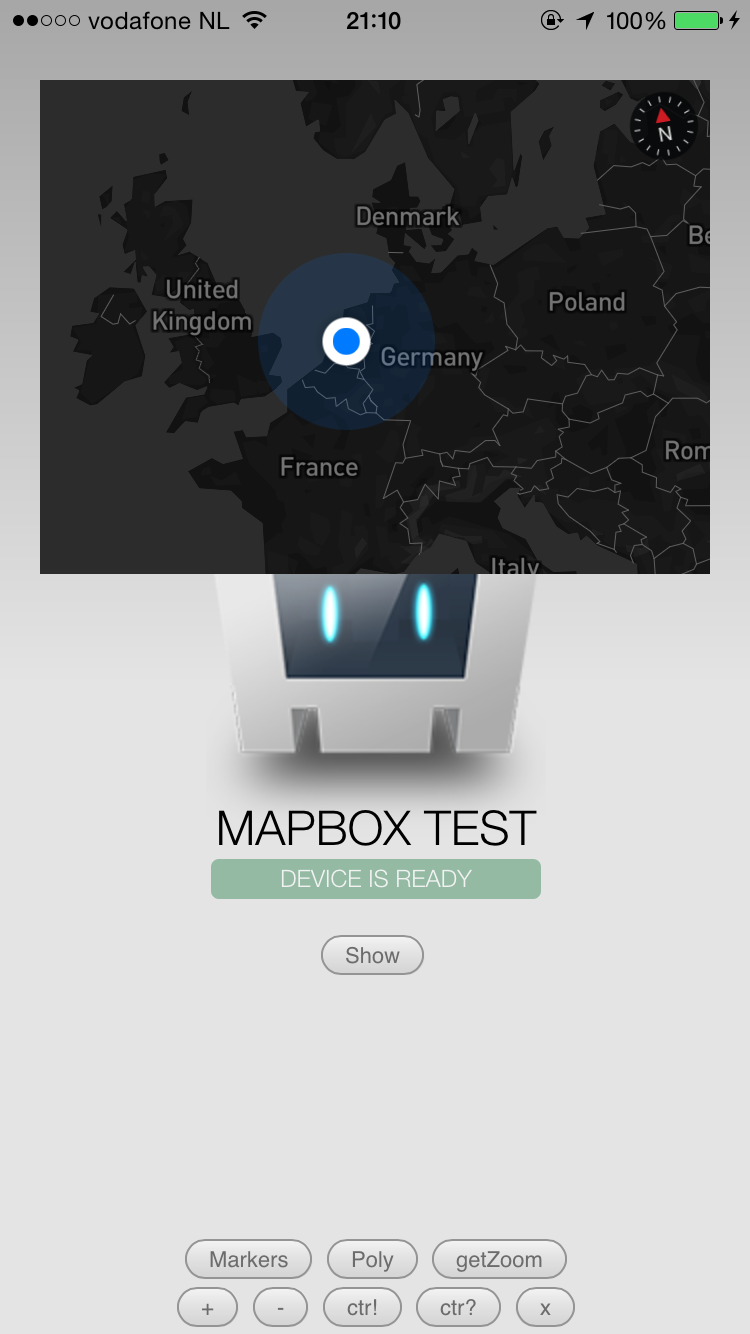 25 |
26 | ### Android
27 |
28 |
25 |
26 | ### Android
27 |
28 | 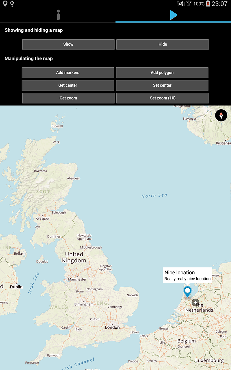 29 |
30 |
31 | ## 3. Installation
32 |
33 | npm (latest stable)
34 | ```
35 | $ cordova plugin add cordova-plugin-mapbox --variable ACCESS_TOKEN=your.access.token
36 | ```
37 |
38 | Github master (lastest develop)
39 | ```
40 | $ cordova plugin add https://github.com/Telerik-Verified-Plugins/Mapbox --variable ACCESS_TOKEN=your.access.token
41 | ```
42 |
43 | Mapbox.js is brought in automatically. There is no need to change or add anything in your html.
44 |
45 | ## 4. Usage
46 |
47 | [We've documented the Mapbox plugin API here.](http://plugins.telerik.com/cordova/plugin/mapbox)
48 |
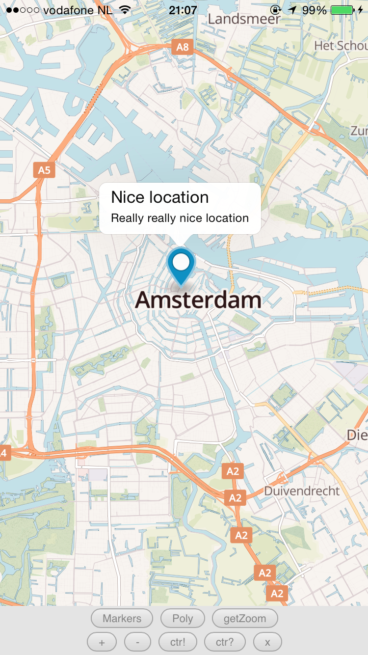
49 | For a quick demo, check the [demo code](demo/index.html) which shows all the tricks in the book.
50 |
51 | ## 5. License
52 |
53 | [The MIT License (MIT)](http://www.opensource.org/licenses/mit-license.html)
54 |
55 | Permission is hereby granted, free of charge, to any person obtaining a copy
56 | of this software and associated documentation files (the "Software"), to deal
57 | in the Software without restriction, including without limitation the rights
58 | to use, copy, modify, merge, publish, distribute, sublicense, and/or sell
59 | copies of the Software, and to permit persons to whom the Software is
60 | furnished to do so, subject to the following conditions:
61 |
62 | The above copyright notice and this permission notice shall be included in
63 | all copies or substantial portions of the Software.
64 |
65 | THE SOFTWARE IS PROVIDED "AS IS", WITHOUT WARRANTY OF ANY KIND, EXPRESS OR
66 | IMPLIED, INCLUDING BUT NOT LIMITED TO THE WARRANTIES OF MERCHANTABILITY,
67 | FITNESS FOR A PARTICULAR PURPOSE AND NONINFRINGEMENT. IN NO EVENT SHALL THE
68 | AUTHORS OR COPYRIGHT HOLDERS BE LIABLE FOR ANY CLAIM, DAMAGES OR OTHER
69 | LIABILITY, WHETHER IN AN ACTION OF CONTRACT, TORT OR OTHERWISE, ARISING FROM,
70 | OUT OF OR IN CONNECTION WITH THE SOFTWARE OR THE USE OR OTHER DEALINGS IN
71 | THE SOFTWARE.
--------------------------------------------------------------------------------
/demo/index.html:
--------------------------------------------------------------------------------
1 |
2 |
3 |
4 |
5 |
6 |
7 |
8 |
9 |
29 |
30 |
31 | ## 3. Installation
32 |
33 | npm (latest stable)
34 | ```
35 | $ cordova plugin add cordova-plugin-mapbox --variable ACCESS_TOKEN=your.access.token
36 | ```
37 |
38 | Github master (lastest develop)
39 | ```
40 | $ cordova plugin add https://github.com/Telerik-Verified-Plugins/Mapbox --variable ACCESS_TOKEN=your.access.token
41 | ```
42 |
43 | Mapbox.js is brought in automatically. There is no need to change or add anything in your html.
44 |
45 | ## 4. Usage
46 |
47 | [We've documented the Mapbox plugin API here.](http://plugins.telerik.com/cordova/plugin/mapbox)
48 |
49 | For a quick demo, check the [demo code](demo/index.html) which shows all the tricks in the book.
50 |
51 | ## 5. License
52 |
53 | [The MIT License (MIT)](http://www.opensource.org/licenses/mit-license.html)
54 |
55 | Permission is hereby granted, free of charge, to any person obtaining a copy
56 | of this software and associated documentation files (the "Software"), to deal
57 | in the Software without restriction, including without limitation the rights
58 | to use, copy, modify, merge, publish, distribute, sublicense, and/or sell
59 | copies of the Software, and to permit persons to whom the Software is
60 | furnished to do so, subject to the following conditions:
61 |
62 | The above copyright notice and this permission notice shall be included in
63 | all copies or substantial portions of the Software.
64 |
65 | THE SOFTWARE IS PROVIDED "AS IS", WITHOUT WARRANTY OF ANY KIND, EXPRESS OR
66 | IMPLIED, INCLUDING BUT NOT LIMITED TO THE WARRANTIES OF MERCHANTABILITY,
67 | FITNESS FOR A PARTICULAR PURPOSE AND NONINFRINGEMENT. IN NO EVENT SHALL THE
68 | AUTHORS OR COPYRIGHT HOLDERS BE LIABLE FOR ANY CLAIM, DAMAGES OR OTHER
69 | LIABILITY, WHETHER IN AN ACTION OF CONTRACT, TORT OR OTHERWISE, ARISING FROM,
70 | OUT OF OR IN CONNECTION WITH THE SOFTWARE OR THE USE OR OTHER DEALINGS IN
71 | THE SOFTWARE.
--------------------------------------------------------------------------------
/demo/index.html:
--------------------------------------------------------------------------------
1 |
2 |
3 |
4 |
5 |
6 |
7 |
8 |
9 | Connecting to Device
17 |Device is Ready
18 |