├── .editorconfig
├── .gitignore
├── .npmignore
├── .travis.yml
├── README.md
├── example.html
├── lib
└── wikigeo.js
├── package.json
├── src
└── wikigeo.coffee
└── test
└── wikigeo.coffee
/.editorconfig:
--------------------------------------------------------------------------------
1 | # EditorConfig helps developers define and maintain consistent
2 | # coding styles between different editors and IDEs
3 | # editorconfig.org
4 |
5 | root = true
6 |
7 |
8 | [*]
9 |
10 | # Change these settings to your own preference
11 | indent_style = space
12 | indent_size = 2
13 |
14 | # We recommend you to keep these unchanged
15 | end_of_line = lf
16 | charset = utf-8
17 | trim_trailing_whitespace = true
18 | insert_final_newline = true
19 |
20 | [*.md]
21 | trim_trailing_whitespace = false
22 |
--------------------------------------------------------------------------------
/.gitignore:
--------------------------------------------------------------------------------
1 | node_modules
2 |
--------------------------------------------------------------------------------
/.npmignore:
--------------------------------------------------------------------------------
1 | node_modules
2 | src
3 | test
4 |
--------------------------------------------------------------------------------
/.travis.yml:
--------------------------------------------------------------------------------
1 | language: node_js
2 |
--------------------------------------------------------------------------------
/README.md:
--------------------------------------------------------------------------------
1 | wikigeo
2 | =======
3 |
4 | [](http://travis-ci.org/edsu/wikigeo)
5 |
6 | wikigeo allows you to fetch [geojson](http://www.geojson.org/geojson-spec.html)
7 | for [Wikipedia](http://wikipedia.org) articles around a given geographic
8 | coordinate. It can be easily added to a map using [Leaflet's geojson
9 | support](http://leafletjs.com/examples/geojson.html). The data comes directly
10 | from the [Wikipedia API](http://en.wikipedia.org/w/api.php) which has the
11 | [GeoData](http://www.mediawiki.org/wiki/Extension:GeoData) extension installed.
12 |
13 | 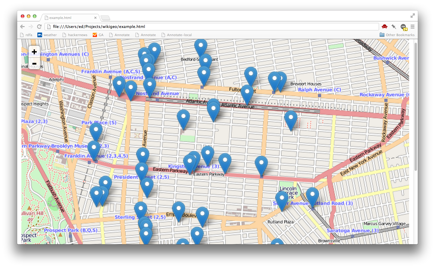
14 |
15 | Basics
16 | ------
17 |
18 | When you add wikigeo.js to your HTML page you will get a function called
19 | `geojson` which you pass a coordinate `[longitude, latitude]` and a callback
20 | function that will receive the geojson data:
21 |
22 | ```javascript
23 | geojson([-73.94, 40.67], function(data) {
24 | console.log(data);
25 | });
26 | ```
27 |
28 | The geojson for this call should look something like:
29 |
30 | ```javascript
31 | {
32 | "type": "FeatureCollection",
33 | "features": [
34 | {
35 | "id": "30854694",
36 | "type": "Feature",
37 | "properties": {
38 | "url": "https://en.wikipedia.org/?curid=30854694",
39 | "name": "Jewish Children\'s Museum",
40 | "touched": "2014-05-18T12:50:57Z"
41 | },
42 | "geometry": {
43 | "type": "Point",
44 | "coordinates": [
45 | -73.9419,
46 | 40.6689
47 | ]
48 | }
49 | },
50 | {
51 | "id": "729460",
52 | "type": "Feature",
53 | "properties": {
54 | "url": "https://en.wikipedia.org/?curid=729460",
55 | "name": "Kingston Avenue (IRT Eastern Parkway Line)",
56 | "touched": "2014-05-13T00:12:17Z"
57 | },
58 | "geometry": {
59 | "type": "Point",
60 | "coordinates": [
61 | -73.9422,
62 | 40.6694
63 | ]
64 | }
65 | }
66 | ]
67 | }
68 | ```
69 |
70 | If you want to get more than 10 results, or increase the radius use the
71 | `limit` and `radius` options:
72 |
73 | ```javascript
74 | geojson([-73.94, 40.67], {radius: 10000, limit: 100}, function(data) {
75 | console.log(data);
76 | });
77 | ```
78 |
79 | Additional Wikipedia Properties
80 | -------------------------------
81 |
82 | Additional properties of the Wikipedia articles can be added to the
83 | geojson feature properties by setting any of the following options to true:
84 | `images`, `categories`, `summaries`, `templates`. For example:
85 |
86 | ```javascript
87 | geojson(
88 | [-73.94, 40.67],
89 | {
90 | limit: 5,
91 | radius: 1000,
92 | images: true,
93 | categories: true,
94 | summaries: true,
95 | templates: true
96 | },
97 | function(data) {
98 | console.log(data);
99 | }
100 | );
101 | ```
102 |
103 | Beware, this can increase your query time since multiple trips to the Wikipedia
104 | API are often required. Here's what the results would look like for the above
105 | call:
106 |
107 | ```javascript
108 |
109 | {
110 | "type": "FeatureCollection",
111 | "features": [
112 | {
113 | "id": "43485",
114 | "type": "Feature",
115 | "properties": {
116 | "url": "https://en.wikipedia.org/?curid=43485",
117 | "name": "Silver Spring, Maryland",
118 | "touched": "2014-05-20T04:25:48Z",
119 | "image": "Silver_Spring_Montage.jpg",
120 | "imageUrl": "https://upload.wikimedia.org/wikipedia/commons/4/48/Silver_Spring_Montage.jpg",
121 | "templates": ["!",
122 | "-",
123 | "Abbr",
124 | "Ambox",
125 | "Both",
126 | "Br separated entries",
127 | "Category handler",
128 | "Citation",
129 | "Citation needed",
130 | "Cite news",
131 | "Cite web",
132 | "Column-width",
133 | "Commons",
134 | "Commons category",
135 | "Convert",
136 | "Coord",
137 | "Country data Maryland",
138 | "Country data United States",
139 | "Country data United States of America",
140 | "DCMetroArea",
141 | "Dead link",
142 | "Expand section",
143 | "Fix",
144 | "Fix/category",
145 | "Flag",
146 | "Flag/core",
147 | "Flagicon image",
148 | "GR",
149 | "Geobox coor",
150 | "Geographic reference",
151 | "Infobox",
152 | "Infobox settlement",
153 | "Infobox settlement/areadisp",
154 | "Infobox settlement/densdisp",
155 | "Infobox settlement/impus",
156 | "Infobox settlement/lengthdisp",
157 | "Infobox settlement/pref",
158 | "Largest cities",
159 | "Largest cities of Maryland",
160 | "Maryland",
161 | "Max",
162 | "Max/2",
163 | "Montgomery County, Maryland",
164 | "Navbar",
165 | "Navbox",
166 | "Navbox subgroup",
167 | "Navboxes",
168 | "Nowrap",
169 | "Order of magnitude",
170 | "Precision",
171 | "Reflist",
172 | "Rnd",
173 | "Side box",
174 | "Sister",
175 | "Talk other",
176 | "Transclude",
177 | "US Census population",
178 | "US county navigation box",
179 | "US state navigation box",
180 | "Unbulleted list",
181 | "Wikivoyage",
182 | "National Register of Historic Places in Maryland",
183 | "Navbar",
184 | "Navbox",
185 | "Reflist",
186 | "Str left",
187 | "Talk other",
188 | "Transclude",
189 | "Arguments",
190 | "Citation/CS1",
191 | "Citation/CS1/Configuration",
192 | "Citation/CS1/Date validation",
193 | "Citation/CS1/Whitelist",
194 | "Coordinates",
195 | "HtmlBuilder",
196 | "Infobox",
197 | "Location map",
198 | "Math",
199 | "Navbar",
200 | "Navbox",
201 | "Yesno"
202 | ],
203 | "summary": "The Polychrome Historic District is a national historic district in the Four Corners neighborhood in Silver Spring, Montgomery County, Maryland. It recognizes a group of five houses built by John Joseph Earley in 1934 and 1935. Earley used precast concrete panels with brightly colored aggregate to produce the polychrome effect, with Art Deco details. The two-inch-thick panels were attached to a conventional wood frame. Earley was interested in the use of mass-production techniques to produce small, inexpensive houses, paralleling Frank Lloyd Wright\'s Usonian house concepts.",
204 | "categories": ["Art Deco architecture in Maryland",
205 | "Coordinates on Wikidata",
206 | "Historic American Buildings Survey in Maryland",
207 | "Historic districts in Maryland",
208 | "Houses in Montgomery County, Maryland",
209 | "Houses on the National Register of Historic Places in Maryland",
210 | "Maryland Registered Historic Place stubs"
211 | ]
212 | },
213 | "geometry": {
214 | "type": "Point",
215 | "coordinates": [
216 | -77.0158,
217 | 39.0181
218 | ]
219 | }
220 | }
221 | ]
222 | }
223 | ```
224 |
225 | Quick Start With Leaflet
226 | ------------------------
227 |
228 | In your HTML, you'll want to use Leaflet as usual:
229 |
230 | ```javascript
231 |
232 | // create the map
233 |
234 | var map = L.map('map').setView([40.67, -73.94], 13);
235 | var osmLayer = L.tileLayer('http://{s}.tile.openstreetmap.org/{z}/{x}/{y}.png', {});
236 | osmLayer.addTo(map);
237 |
238 | // get geojson and add it to the map
239 |
240 | geojson([-73.94, 40.67], {radius: 10000, limit: 50}, function(data) {
241 | L.geoJson(data).addTo(map)
242 | });
243 | ```
244 |
245 | Please note that the order of geo coordinates in Leaflet is (lat, lon) whereas
246 | in geojson it is (lon, lat).
247 |
248 | That's it, to get the basic functionality working. Open example.html for a
249 | working example.
250 |
251 | Develop
252 | -------
253 |
254 | If you want to hack on wikigeo you'll need [Node](http://nodejs.org) and
255 | then you'll need to install some dependencies for testing:
256 |
257 | npm install
258 |
259 | This will install mocha, which you can use to run the tests, simply do:
260 |
261 | npm test
262 |
263 | and you should see something like a nyan cat:
264 |
265 | ```
266 | > wikigeo@1.0.0 test /home/despairblue/vcs/git/wikigeo
267 | > mocha --colors --reporter nyan --compilers coffee:coffee-script/register test/wikigeo.coffee
268 |
269 | 11 -_-_-_-_-_-__,------,
270 | 0 -_-_-_-_-_-__| /\_/\
271 | 0 -_-_-_-_-_-_~|_( ^ .^)
272 | -_-_-_-_-_-_ "" ""
273 |
274 | 11 passing (5s)
275 | ```
276 |
277 | License
278 | -------
279 |
280 | [](http://creativecommons.org/publicdomain/zero/1.0/)
281 |
--------------------------------------------------------------------------------
/example.html:
--------------------------------------------------------------------------------
1 |
2 |
3 |
4 |
5 |
10 |
11 |
12 |
13 |
14 |
15 |
16 |
17 |
32 |
33 |
34 |
35 |
--------------------------------------------------------------------------------
/lib/wikigeo.js:
--------------------------------------------------------------------------------
1 | // Generated by CoffeeScript 1.6.2
2 | /*
3 |
4 | geojson takes a geo coordinate (longitude, latitude) and a callback that will
5 | be given geojson for Wikipedia articles that are relevant for that location
6 |
7 | options:
8 | radius: search radius in meters (default: 1000, max: 10000)
9 | limit: the number of wikipedia articles to limit to (default: 10, max: 500)
10 | images: set to true to get filename images for the article
11 | summaries: set to true to get short text summaries for the article
12 | templates: set to true to get a list of templates used in the article
13 | categories: set to true to get a list of categories the article is in
14 |
15 | example:
16 | geojson([-77.0155, 39.0114], {radius: 5000}, function(data) {
17 | console.log(data);
18 | })
19 | */
20 |
21 | var error, fetch, geojson, request, root, _browserFetch, _clean, _convert, _fetch, _search,
22 | _this = this;
23 |
24 | geojson = function(geo, opts, callback) {
25 | if (opts == null) {
26 | opts = {};
27 | }
28 | if (typeof opts === "function") {
29 | callback = opts;
30 | opts = {};
31 | }
32 | if (!opts.limit) {
33 | opts.limit = 10;
34 | }
35 | if (!opts.radius) {
36 | opts.radius = 10000;
37 | }
38 | if (!opts.language) {
39 | opts.language = "en";
40 | }
41 | if (opts.radius > 10000) {
42 | throw new Error("radius cannot be greater than 10000");
43 | }
44 | if (opts.limit > 500) {
45 | throw new Error("limit cannot be greater than 500");
46 | }
47 | return _search(geo, opts, callback);
48 | };
49 |
50 | _search = function(geo, opts, callback, results, queryContinue) {
51 | var continueParams, name, param, q, url;
52 |
53 | url = "http://" + opts.language + ".wikipedia.org/w/api.php";
54 | q = {
55 | action: "query",
56 | prop: "info|coordinates",
57 | generator: "geosearch",
58 | ggsradius: opts.radius,
59 | ggscoord: "" + geo[1] + "|" + geo[0],
60 | ggslimit: opts.limit,
61 | format: "json"
62 | };
63 | if (opts.images) {
64 | q.prop += "|pageprops";
65 | }
66 | if (opts.summaries) {
67 | q.prop += "|extracts";
68 | q.exlimit = "max";
69 | q.exintro = 1;
70 | q.explaintext = 1;
71 | }
72 | if (opts.templates) {
73 | q.prop += "|templates";
74 | q.tllimit = 500;
75 | }
76 | if (opts.categories) {
77 | q.prop += "|categories";
78 | q.cllimit = 500;
79 | }
80 | continueParams = {
81 | extracts: "excontinue",
82 | coordinates: "cocontinue",
83 | templates: "tlcontinue",
84 | categories: "clcontinue"
85 | };
86 | if (queryContinue) {
87 | for (name in continueParams) {
88 | param = continueParams[name];
89 | if (queryContinue[name]) {
90 | q[param] = queryContinue[name][param];
91 | }
92 | }
93 | }
94 | return fetch(url, {
95 | params: q
96 | }, function(response) {
97 | var article, articleId, first, newValues, prop, resultsArticle, _ref;
98 |
99 | if (!results) {
100 | first = true;
101 | results = response;
102 | } else {
103 | first = false;
104 | }
105 | if (!(response.query && response.query.pages)) {
106 | _convert(results, opts, callback);
107 | return;
108 | }
109 | _ref = response.query.pages;
110 | for (articleId in _ref) {
111 | article = _ref[articleId];
112 | resultsArticle = results.query.pages[articleId];
113 | if (!resultsArticle) {
114 | continue;
115 | }
116 | for (prop in continueParams) {
117 | param = continueParams[prop];
118 | if (prop === 'extracts') {
119 | prop = 'extract';
120 | }
121 | newValues = article[prop];
122 | if (!newValues) {
123 | continue;
124 | }
125 | if (Array.isArray(newValues)) {
126 | if (!resultsArticle[prop]) {
127 | resultsArticle[prop] = newValues;
128 | } else if (!first && resultsArticle[prop][-1] !== newValues[-1]) {
129 | resultsArticle[prop] = resultsArticle[prop].concat(newValues);
130 | }
131 | } else {
132 | resultsArticle[prop] = article[prop];
133 | }
134 | }
135 | }
136 | if (response['query-continue']) {
137 | if (!queryContinue) {
138 | queryContinue = response['query-continue'];
139 | } else {
140 | for (name in continueParams) {
141 | param = continueParams[name];
142 | if (response['query-continue'][name]) {
143 | queryContinue[name] = response['query-continue'][name];
144 | }
145 | }
146 | }
147 | return _search(geo, opts, callback, results, queryContinue);
148 | } else {
149 | return _convert(results, opts, callback);
150 | }
151 | });
152 | };
153 |
154 | _convert = function(results, opts, callback) {
155 | var article, articleId, feature, geo, image, imageUrl, md5sum, titleEscaped, url, _ref;
156 |
157 | geo = {
158 | type: "FeatureCollection",
159 | features: []
160 | };
161 | if (!(results && results.query && results.query.pages)) {
162 | callback(geo);
163 | return;
164 | }
165 | _ref = results.query.pages;
166 | for (articleId in _ref) {
167 | article = _ref[articleId];
168 | if (!article.coordinates) {
169 | continue;
170 | }
171 | titleEscaped = article.title.replace(/\s/g, "_");
172 | url = "https://" + opts.language + ".wikipedia.org/?curid=" + articleId;
173 | feature = {
174 | id: articleId,
175 | type: "Feature",
176 | properties: {
177 | url: url,
178 | name: article.title,
179 | touched: article.touched
180 | },
181 | geometry: {
182 | type: "Point",
183 | coordinates: [Number(article.coordinates[0].lon), Number(article.coordinates[0].lat)]
184 | }
185 | };
186 | if (opts.images) {
187 | if (article.pageprops) {
188 | md5sum = require('crypto').createHash('md5').update(article.pageprops.page_image).digest("hex");
189 | image = article.pageprops.page_image;
190 | imageUrl = "https://upload.wikimedia.org/wikipedia/commons/" + md5sum[0] + "/" + md5sum.slice(0, 2) + "/" + article.pageprops.page_image;
191 | } else {
192 | image = null;
193 | imageUrl = null;
194 | }
195 | feature.properties.image = image;
196 | feature.properties.imageUrl = imageUrl;
197 | }
198 | if (opts.templates) {
199 | feature.properties.templates = _clean(article.templates);
200 | }
201 | if (opts.summaries) {
202 | feature.properties.summary = article.extract;
203 | }
204 | if (opts.categories) {
205 | feature.properties.categories = _clean(article.categories);
206 | }
207 | geo.features.push(feature);
208 | }
209 | callback(geo);
210 | };
211 |
212 | _clean = function(list) {
213 | var i;
214 |
215 | return (function() {
216 | var _i, _len, _results;
217 |
218 | _results = [];
219 | for (_i = 0, _len = list.length; _i < _len; _i++) {
220 | i = list[_i];
221 | _results.push(i.title.replace(/^.+?:/, ''));
222 | }
223 | return _results;
224 | })();
225 | };
226 |
227 | _fetch = function(uri, opts, callback) {
228 | return request(uri, {
229 | qs: opts.params,
230 | json: true
231 | }, function(e, r, data) {
232 | return callback(data);
233 | });
234 | };
235 |
236 | _browserFetch = function(uri, opts, callback) {
237 | return $.ajax({
238 | url: uri,
239 | data: opts.params,
240 | dataType: "jsonp",
241 | success: function(response) {
242 | return callback(response);
243 | }
244 | });
245 | };
246 |
247 | try {
248 | request = require('request');
249 | fetch = _fetch;
250 | } catch (_error) {
251 | error = _error;
252 | fetch = _browserFetch;
253 | }
254 |
255 | root = typeof exports !== "undefined" && exports !== null ? exports : this;
256 |
257 | root.geojson = geojson;
258 |
--------------------------------------------------------------------------------
/package.json:
--------------------------------------------------------------------------------
1 | {
2 | "name": "wikigeo",
3 | "version": "1.0.1",
4 | "main": "lib/wikigeo",
5 | "scripts": {
6 | "build": "coffee --bare --compile --output lib src/wikigeo.coffee",
7 | "prepublish": "coffee --bare --compile --output lib src/wikigeo.coffee",
8 | "watch": "coffee -w --output lib src/wikigeo.coffee",
9 | "test": "mocha --colors --reporter nyan --compilers coffee:coffee-script/register test/wikigeo.coffee"
10 | },
11 | "dependencies": {
12 | "coffee-script": "^1.7.1",
13 | "request": "^2.35.0"
14 | },
15 | "devDependencies": {
16 | "chai": "^1.9.1",
17 | "mocha": "^1.19.0"
18 | }
19 | }
20 |
--------------------------------------------------------------------------------
/src/wikigeo.coffee:
--------------------------------------------------------------------------------
1 | ###
2 |
3 | geojson takes a geo coordinate (longitude, latitude) and a callback that will
4 | be given geojson for Wikipedia articles that are relevant for that location
5 |
6 | options:
7 | radius: search radius in meters (default: 1000, max: 10000)
8 | limit: the number of wikipedia articles to limit to (default: 10, max: 500)
9 | images: set to true to get filename images for the article
10 | summaries: set to true to get short text summaries for the article
11 | templates: set to true to get a list of templates used in the article
12 | categories: set to true to get a list of categories the article is in
13 |
14 | example:
15 | geojson([-77.0155, 39.0114], {radius: 5000}, function(data) {
16 | console.log(data);
17 | })
18 |
19 | ###
20 |
21 | geojson = (geo, opts={}, callback) =>
22 | if typeof opts == "function"
23 | callback = opts
24 | opts = {}
25 | opts.limit = 10 if not opts.limit
26 | opts.radius = 10000 if not opts.radius
27 |
28 | if not opts.language
29 | opts.language = "en"
30 |
31 | if opts.radius > 10000
32 | throw new Error("radius cannot be greater than 10000")
33 |
34 | if opts.limit > 500
35 | throw new Error("limit cannot be greater than 500")
36 |
37 | _search(geo, opts, callback)
38 |
39 |
40 | #
41 | # recursive function to collect the results from all search result pages
42 | #
43 |
44 | _search = (geo, opts, callback, results, queryContinue) =>
45 | url = "http://#{ opts.language }.wikipedia.org/w/api.php"
46 | q =
47 | action: "query"
48 | prop: "info|coordinates"
49 | generator: "geosearch"
50 | ggsradius: opts.radius
51 | ggscoord: "#{geo[1]}|#{geo[0]}"
52 | ggslimit: opts.limit
53 | format: "json"
54 |
55 | if opts.images
56 | q.prop += "|pageprops"
57 |
58 | if opts.summaries
59 | q.prop += "|extracts"
60 | q.exlimit = "max"
61 | q.exintro = 1
62 | q.explaintext = 1
63 |
64 | if opts.templates
65 | q.prop += "|templates"
66 | q.tllimit = 500
67 |
68 | if opts.categories
69 | q.prop += "|categories"
70 | q.cllimit = 500
71 |
72 | # add continue parameters if they have been provided, these are
73 | # parameters that are used to fetch more results from the api
74 |
75 | continueParams =
76 | extracts: "excontinue"
77 | coordinates: "cocontinue"
78 | templates: "tlcontinue"
79 | categories: "clcontinue"
80 |
81 | if queryContinue
82 | for name, param of continueParams
83 | if queryContinue[name]
84 | q[param] = queryContinue[name][param]
85 |
86 | fetch url, params: q, (response) =>
87 |
88 | if not results
89 | first = true
90 | results = response
91 | else
92 | first = false
93 |
94 | # no results, oh well just give them empty geojson
95 | if not (response.query and response.query.pages)
96 | _convert(results, opts, callback)
97 | return
98 |
99 | for articleId, article of response.query.pages
100 | resultsArticle = results.query.pages[articleId]
101 | if not resultsArticle
102 | continue
103 |
104 | # this parameter is singular in article data...
105 | for prop, param of continueParams
106 | if prop == 'extracts'
107 | prop = 'extract'
108 |
109 | # continue if there are no new values to merge
110 | newValues = article[prop]
111 | if not newValues
112 | continue
113 |
114 | # merge arrays by concatenating with old values
115 | if Array.isArray(newValues)
116 | if not resultsArticle[prop]
117 | resultsArticle[prop] = newValues
118 | else if not first and resultsArticle[prop][-1] != newValues[-1]
119 | resultsArticle[prop] = resultsArticle[prop].concat(newValues)
120 |
121 | # otherwise just assign
122 | else
123 | resultsArticle[prop] = article[prop]
124 |
125 | if response['query-continue']
126 | if not queryContinue
127 | queryContinue = response['query-continue']
128 | else
129 | for name, param of continueParams
130 | if response['query-continue'][name]
131 | queryContinue[name] = response['query-continue'][name]
132 | _search(geo, opts, callback, results, queryContinue)
133 |
134 | else
135 | _convert(results, opts, callback)
136 |
137 |
138 | #
139 | # do the work of converting a wikipedia response to geojson
140 | #
141 |
142 | _convert = (results, opts, callback) ->
143 | geo =
144 | type: "FeatureCollection"
145 | features: []
146 |
147 | if not (results and results.query and results.query.pages)
148 | callback(geo)
149 | return
150 |
151 | for articleId, article of results.query.pages
152 | if not article.coordinates
153 | continue
154 |
155 | titleEscaped = article.title.replace /\s/g, "_"
156 | url = "https://#{opts.language}.wikipedia.org/?curid=#{articleId}"
157 |
158 | feature =
159 | id: articleId
160 | type: "Feature"
161 | properties:
162 | url: url
163 | name: article.title
164 | touched: article.touched
165 | geometry:
166 | type: "Point"
167 | coordinates: [
168 | (Number) article.coordinates[0].lon
169 | (Number) article.coordinates[0].lat
170 | ]
171 |
172 | if opts.images
173 | if article.pageprops?.page_image
174 | # @see https://www.mediawiki.org/wiki/Manual:$wgHashedUploadDirectory
175 | md5sum = require('crypto').createHash('md5').update(article.pageprops.page_image).digest("hex")
176 | image = article.pageprops.page_image
177 | imageUrl = "https://upload.wikimedia.org/wikipedia/commons/#{md5sum[0]}/#{md5sum[0..1]}/#{article.pageprops.page_image}"
178 | else
179 | image = null
180 | imageUrl = null
181 | feature.properties.image = image
182 | feature.properties.imageUrl = imageUrl
183 |
184 | if opts.templates
185 | feature.properties.templates = _clean(article.templates)
186 |
187 | if opts.summaries
188 | feature.properties.summary = article.extract
189 |
190 | if opts.categories
191 | feature.properties.categories = _clean(article.categories)
192 |
193 | geo.features.push feature
194 |
195 | callback(geo)
196 | return
197 |
198 | #
199 | # strip wikipedia specific information
200 | #
201 |
202 | _clean = (list) ->
203 | return (i.title.replace(/^.+?:/, '') for i in list)
204 |
205 | #
206 | # helpers for doing http in browser (w/ jQuery) and in node (w/ request)
207 | #
208 |
209 | _fetch = (uri, opts, callback) ->
210 | request uri, qs: opts.params, json: true, (e, r, data) ->
211 | callback(data)
212 |
213 | _browserFetch = (uri, opts, callback) ->
214 | $.ajax url: uri, data: opts.params, dataType: "jsonp", success: (response) ->
215 | callback(response)
216 |
217 | try
218 | request = require('request')
219 | fetch = _fetch
220 | catch error
221 | fetch = _browserFetch
222 |
223 | root = exports ? this
224 | root.geojson = geojson
225 |
--------------------------------------------------------------------------------
/test/wikigeo.coffee:
--------------------------------------------------------------------------------
1 | wikigeo = require '../src/wikigeo'
2 | geojson = wikigeo.geojson
3 | assert = require('chai').assert
4 |
5 | describe 'wikigeo', ->
6 |
7 | describe 'geojson', ->
8 | this.timeout(10000)
9 |
10 | it 'should work with just lat/lon', (done) ->
11 | geojson [-73.94, 40.67], (data) ->
12 | assert.equal data.type, "FeatureCollection"
13 | assert.ok data.features
14 | assert.ok Array.isArray(data.features)
15 | assert.ok data.features.length > 0 and data.features.length <= 10
16 |
17 | f = data.features[0]
18 | assert.ok f.id
19 | assert.ok f.properties.url
20 | assert.match f.properties.url, /https:\/\/en.wikipedia.org\//
21 | assert.equal f.type, "Feature"
22 | assert.ok f.properties
23 | assert.ok f.properties.name
24 | assert.ok f.properties.touched
25 | assert.ok f.geometry
26 | assert.equal f.geometry.type, "Point"
27 | assert.ok f.geometry.coordinates
28 | assert.equal typeof f.geometry.coordinates[0], "number"
29 | assert.equal typeof f.geometry.coordinates[1], "number"
30 | done()
31 |
32 | it 'should return empty results when there are no hits', (done) ->
33 | geojson [77.0155, 39.0114], (data) ->
34 | assert.equal data.type, "FeatureCollection"
35 | assert.ok data.features
36 | assert.ok Array.isArray(data.features)
37 | assert.equal data.features.length, 0
38 | done()
39 |
40 | it 'should be able to get summaries', (done) ->
41 | geojson [-77.0155, 39.0114], summaries: true, (data) ->
42 | assert.ok data.features[0].properties.summary
43 | done()
44 |
45 | it 'should be able to get images', (done) ->
46 | geojson [-77.0155, 39.0114], images: true, (data) ->
47 | assert.ok data.features[0].properties.image
48 | done()
49 |
50 | it 'should contain an imageUrl', (done) ->
51 | geojson [-77.0155, 39.0114], images: true, (data) ->
52 | assert.match data.features[0].properties.imageUrl, /https:\/\/upload.wikimedia.org\/wikipedia\/commons/
53 | done()
54 |
55 | it 'should be able to get templates', (done) ->
56 | geojson [-77.0155, 39.0114], templates: true, (data) ->
57 | assert.ok data.features[0].properties.templates
58 | done()
59 |
60 | it 'should be able to get categories', (done) ->
61 | geojson [-77.0155, 39.0114], categories: true, (data) ->
62 | assert.ok data.features[0].properties.categories
63 | done()
64 |
65 | it 'limit should cause more results to come in', (done) ->
66 | geojson [-77.0155, 39.0114], limit: 100, (data) ->
67 | assert.ok data.features.length > 5 and data.features.length < 100
68 | done()
69 |
70 | it 'respects maximum limit', (done) ->
71 | doit = -> geojson([-77.0155, 39.0114], limit: 501, (data) ->)
72 | assert.throws doit, 'limit cannot be greater than 500'
73 | done()
74 |
75 | it 'respects maximum radius', (done) ->
76 | doit = -> geojson([-77.0155, 39.0114], radius: 10001, (data) ->)
77 | assert.throws doit, 'radius cannot be greater than 10000'
78 | done()
79 |
80 | it 'allows for non en wikipedias', (done) ->
81 | geojson [-77.0155, 39.0114], language: 'de', (data) ->
82 | assert.match data.features[0].properties.url, /https:\/\/de\.wikipedia\.org/
83 | done()
84 |
--------------------------------------------------------------------------------