├── .gitignore
├── images
├── back.png
├── list-icon.png
├── leaflet-geojson-selector.jpg
└── list-icon.svg
├── package.json
├── dist
├── leaflet-geojson-selector.min.css
├── leaflet-geojson-selector.src.css
├── leaflet-geojson-selector.min.js
└── leaflet-geojson-selector.src.js
├── src
├── leaflet-geojson-selector.css
└── leaflet-geojson-selector.js
├── examples
├── style.css
├── points.html
├── simple.html
├── multi.html
├── custom-item.html
├── reload-layer.html
└── italy-regions-centroids.json
├── Gruntfile.js
├── index.html
└── README.md
/.gitignore:
--------------------------------------------------------------------------------
1 | npm-debug.log
2 | node_modules
3 |
--------------------------------------------------------------------------------
/images/back.png:
--------------------------------------------------------------------------------
https://raw.githubusercontent.com/stefanocudini/leaflet-geojson-selector/HEAD/images/back.png
--------------------------------------------------------------------------------
/images/list-icon.png:
--------------------------------------------------------------------------------
https://raw.githubusercontent.com/stefanocudini/leaflet-geojson-selector/HEAD/images/list-icon.png
--------------------------------------------------------------------------------
/images/leaflet-geojson-selector.jpg:
--------------------------------------------------------------------------------
https://raw.githubusercontent.com/stefanocudini/leaflet-geojson-selector/HEAD/images/leaflet-geojson-selector.jpg
--------------------------------------------------------------------------------
/package.json:
--------------------------------------------------------------------------------
1 | {
2 | "name": "leaflet-geojson-selector",
3 | "version": "0.5.5",
4 | "description": "Leaflet Control for select GeoJSON properties in a interactive menu and map",
5 | "repository": {
6 | "type": "git",
7 | "url": "git@github.com:stefanocudini/leaflet-geojson-selector.git"
8 | },
9 | "homepage": "https://opengeo.tech/maps/leaflet-geojson-selector/",
10 | "author": {
11 | "name": "Stefano Cudini",
12 | "email": "stefano.cudini@gmail.com",
13 | "url": "https://opengeo.tech/"
14 | },
15 | "main": "dist/leaflet-geojson-selector.src.js",
16 | "license": "MIT",
17 | "keywords": [
18 | "gis",
19 | "map",
20 | "geojson",
21 | "leaflet"
22 | ],
23 | "dependencies": {
24 | "leaflet": "^1.3.4"
25 | },
26 | "devDependencies": {
27 | "grunt": "~0.4.2",
28 | "grunt-cli": "~0.1.11",
29 | "grunt-contrib-clean": "~0.5.0",
30 | "grunt-contrib-concat": "~0.3.0",
31 | "grunt-contrib-cssmin": "~0.7.0",
32 | "grunt-contrib-jshint": "~0.7.2",
33 | "grunt-contrib-uglify": "~0.2.7",
34 | "jquery": "~3.0.0",
35 | "osmtogeojson": "^2.2.5"
36 | }
37 | }
38 |
--------------------------------------------------------------------------------
/dist/leaflet-geojson-selector.min.css:
--------------------------------------------------------------------------------
1 | /*
2 | * Leaflet GeoJSON Selector v0.5.4 - 2018-09-28
3 | *
4 | * Copyright 2018 Stefano Cudini
5 | * stefano.cudini@gmail.com
6 | * https://opengeo.tech/
7 | *
8 | * Licensed under the MIT license.
9 | *
10 | * Demo:
11 | * https://opengeo.tech/maps/leaflet-geojson-selector/
12 | *
13 | * Source:
14 | * git@github.com:stefanocudini/leaflet-geojson-selector.git
15 | *
16 | */
17 |
18 | .leaflet-container .geojson-list{position:relative;float:left;color:#1978cf;-moz-border-radius:4px;-webkit-border-radius:4px;border-radius:0;background-color:rgba(255,255,255,.6);z-index:1000;box-shadow:0 1px 7px rgba(0,0,0,.65);margin:0;min-width:50px;min-height:26px;overflow-y:scroll}.geojson-list-group{list-style:none;padding:0;margin:0}.geojson-list-item{padding:0;margin:0;clear:both;cursor:pointer;display:block;overflow:hidden;line-height:18px;vertical-align:middle;font-size:14px;min-width:120px;color:#666;text-decoration:none;border-bottom:1px solid rgba(0,0,0,.5);-moz-user-select:none;-khtml-user-select:none;-webkit-user-select:none;-ms-user-select:none;user-select:none;white-space:nowrap;text-transform:capitalize}.geojson-list-item.active,.geojson-list-item:hover{display:block;color:#666;text-decoration:none;background-color:rgba(255,204,0,.6)}.geojson-list-item.selected{color:#666;background-color:rgba(255,136,0,.8)}.geojson-list-item input{line-height:18px;margin:4px}.geojson-list-item label{display:block;cursor:pointer;vertical-align:middle}.leaflet-control.geojson-list .geojson-list-group{display:block}
--------------------------------------------------------------------------------
/src/leaflet-geojson-selector.css:
--------------------------------------------------------------------------------
1 |
2 | .leaflet-container .geojson-list {
3 | position:relative;
4 | float:left;
5 | color:#1978cf;
6 | -moz-border-radius: 4px;
7 | -webkit-border-radius: 4px;
8 | border-radius: 0;
9 | background-color: rgba(255, 255, 255, 0.6);
10 | z-index:1000;
11 | box-shadow: 0 1px 7px rgba(0,0,0,0.65);
12 | margin: 0;
13 | min-width: 50px;
14 | min-height:26px;
15 | overflow-y: scroll;
16 | }
17 | .geojson-list-group {
18 | list-style: none;
19 | padding: 0;
20 | margin: 0;
21 | }
22 | .geojson-list-item {
23 | padding: 0;
24 | margin: 0;
25 | clear: both;
26 | cursor: pointer;
27 | display: block;
28 | overflow: hidden;
29 | line-height: 18px;
30 | vertical-align: middle;
31 | font-size: 14px;
32 | min-width: 120px;
33 | color: #666;
34 | text-decoration: none;
35 | border-bottom: 1px solid rgba(0,0,0, 0.5);
36 | -moz-user-select: none;
37 | -khtml-user-select: none;
38 | -webkit-user-select: none;
39 | -ms-user-select: none;
40 | user-select: none;
41 |
42 | white-space: nowrap;
43 | text-transform: capitalize;
44 | }
45 | .geojson-list-item:hover,
46 | .geojson-list-item.active {
47 | display: block;
48 | color: #666;
49 | text-decoration: none;
50 | background-color: rgba(255,204,0, 0.6); /* #FFCC00 */
51 | }
52 | .geojson-list-item.selected {
53 | color: #666;
54 | background-color: rgba(255,136,0, 0.8); /* #FF8800 */
55 | }
56 | .geojson-list-item input {
57 | line-height: 18px;
58 | margin: 4px;
59 | }
60 | .geojson-list-item label {
61 | display: block;
62 | cursor: pointer;
63 | vertical-align: middle;
64 | }
65 | .leaflet-control.geojson-list .geojson-list-group {
66 | display: block;
67 | }
68 |
--------------------------------------------------------------------------------
/dist/leaflet-geojson-selector.src.css:
--------------------------------------------------------------------------------
1 | /*
2 | * Leaflet GeoJSON Selector v0.5.4 - 2018-09-28
3 | *
4 | * Copyright 2018 Stefano Cudini
5 | * stefano.cudini@gmail.com
6 | * https://opengeo.tech/
7 | *
8 | * Licensed under the MIT license.
9 | *
10 | * Demo:
11 | * https://opengeo.tech/maps/leaflet-geojson-selector/
12 | *
13 | * Source:
14 | * git@github.com:stefanocudini/leaflet-geojson-selector.git
15 | *
16 | */
17 |
18 | .leaflet-container .geojson-list {
19 | position:relative;
20 | float:left;
21 | color:#1978cf;
22 | -moz-border-radius: 4px;
23 | -webkit-border-radius: 4px;
24 | border-radius: 0;
25 | background-color: rgba(255, 255, 255, 0.6);
26 | z-index:1000;
27 | box-shadow: 0 1px 7px rgba(0,0,0,0.65);
28 | margin: 0;
29 | min-width: 50px;
30 | min-height:26px;
31 | overflow-y: scroll;
32 | }
33 | .geojson-list-group {
34 | list-style: none;
35 | padding: 0;
36 | margin: 0;
37 | }
38 | .geojson-list-item {
39 | padding: 0;
40 | margin: 0;
41 | clear: both;
42 | cursor: pointer;
43 | display: block;
44 | overflow: hidden;
45 | line-height: 18px;
46 | vertical-align: middle;
47 | font-size: 14px;
48 | min-width: 120px;
49 | color: #666;
50 | text-decoration: none;
51 | border-bottom: 1px solid rgba(0,0,0, 0.5);
52 | -moz-user-select: none;
53 | -khtml-user-select: none;
54 | -webkit-user-select: none;
55 | -ms-user-select: none;
56 | user-select: none;
57 |
58 | white-space: nowrap;
59 | text-transform: capitalize;
60 | }
61 | .geojson-list-item:hover,
62 | .geojson-list-item.active {
63 | display: block;
64 | color: #666;
65 | text-decoration: none;
66 | background-color: rgba(255,204,0, 0.6); /* #FFCC00 */
67 | }
68 | .geojson-list-item.selected {
69 | color: #666;
70 | background-color: rgba(255,136,0, 0.8); /* #FF8800 */
71 | }
72 | .geojson-list-item input {
73 | line-height: 18px;
74 | margin: 4px;
75 | }
76 | .geojson-list-item label {
77 | display: block;
78 | cursor: pointer;
79 | vertical-align: middle;
80 | }
81 | .leaflet-control.geojson-list .geojson-list-group {
82 | display: block;
83 | }
84 |
--------------------------------------------------------------------------------
/examples/style.css:
--------------------------------------------------------------------------------
1 | body {
2 | background:#b5d0d0;
3 | color:#285585;
4 | font-family:Arial;
5 | }
6 | body#home {
7 | /*background:url('images/back.png') no-repeat top left #b5d0d0;*/
8 | margin-left:150px;
9 | }
10 |
11 | a {
12 | color:#1978cf;
13 | }
14 | a:hover {
15 | color:#fff;
16 | }
17 | h2, h3, h4 {
18 | white-space:nowrap;
19 | margin:1em 0;
20 | }
21 | h3 a,
22 | h3 a:hover {
23 | text-decoration:none;
24 | }
25 |
26 | table {
27 | border-collapse: collapse;
28 | }
29 |
30 | table {
31 | border-collapse: collapse;
32 | width: 100%;
33 | }
34 |
35 | th, td {
36 | text-align: left;
37 | padding: 4px;
38 | }
39 | tr:nth-child(even) {background-color: #f2f2f2;}
40 |
41 | #desc {
42 | float: left;
43 | margin-bottom: 1em;
44 | position: relative;
45 | white-space:nowrap;
46 | font-size:1em;
47 | }
48 | .leaflet-container {
49 | border-radius:.125em;
50 | border:2px solid #1978cf;
51 | box-shadow: 0 0 8px #999;
52 | float:left;
53 | width:800px;
54 | height:400px;
55 | }
56 | .selection {
57 | min-width: 200px;
58 | padding: 4px;
59 | border-radius: 4px;
60 | box-shadow: 0 1px 5px rgba(0,0,0,0.65);
61 | clear: both;
62 | background: #fefefe;
63 | white-space: nowrap;
64 | }
65 | ul {
66 | font-size:.85em;
67 | margin:0;
68 | padding:0;
69 | }
70 | li {
71 | margin:0 0 2px 18px;
72 | }
73 | #copy {
74 | position:fixed;
75 | z-index:1000;
76 | right:150px;
77 | top:-8px;
78 | font-size:.85em;
79 | padding:8px 8px 2px 8px;
80 | background: #323b44;
81 | border: 2px solid #737c85;
82 | border-radius:.7em;
83 | opacity: 0.9;
84 | box-shadow:0 0 8px #5f7182;
85 | color:#eee
86 | }
87 | #copy a {
88 | color:#ccc;
89 | text-decoration:none
90 | }
91 | #copy a:hover {
92 | color:#fff
93 | }
94 | #ribbon {
95 | position: absolute;
96 | top: 0;
97 | right: 0;
98 | border: 0;
99 | filter: alpha(opacity=80);
100 | -khtml-opacity: .8;
101 | -moz-opacity: .8;
102 | opacity: .8;
103 | }
104 | .contents {
105 | float:left;
106 | margin:0 2em 2em 0;
107 | }
108 | #comments {
109 | clear:both;
110 | }
111 |
112 |
--------------------------------------------------------------------------------
/examples/points.html:
--------------------------------------------------------------------------------
1 |
2 |
3 |
4 |
5 |
6 |
7 |
8 |
9 |
10 |
11 |
12 | Points Example: Italian regions Centroids
13 |
14 |
15 |
16 |
17 |
18 |
19 |
20 |
62 |
63 |
64 |
65 |
66 |
67 |
--------------------------------------------------------------------------------
/Gruntfile.js:
--------------------------------------------------------------------------------
1 | 'use strict';
2 |
3 | module.exports = function(grunt) {
4 |
5 | grunt.loadNpmTasks('grunt-contrib-uglify');
6 | grunt.loadNpmTasks('grunt-contrib-concat');
7 | grunt.loadNpmTasks('grunt-contrib-clean');
8 | grunt.loadNpmTasks('grunt-contrib-cssmin');
9 | grunt.loadNpmTasks('grunt-contrib-jshint');
10 |
11 | grunt.initConfig({
12 | pkg: grunt.file.readJSON('package.json'),
13 | meta: {
14 | banner:
15 | '/* \n'+
16 | ' * Leaflet GeoJSON Selector v<%= pkg.version %> - <%= grunt.template.today("yyyy-mm-dd") %> \n'+
17 | ' * \n'+
18 | ' * Copyright <%= grunt.template.today("yyyy") %> <%= pkg.author.name %> \n'+
19 | ' * <%= pkg.author.email %> \n'+
20 | ' * <%= pkg.author.url %> \n'+
21 | ' * \n'+
22 | ' * Licensed under the <%= pkg.license %> license. \n'+
23 | ' * \n'+
24 | ' * Demo: \n'+
25 | ' * <%= pkg.homepage %> \n'+
26 | ' * \n'+
27 | ' * Source: \n'+
28 | ' * <%= pkg.repository.url %> \n'+
29 | ' * \n'+
30 | ' */\n'
31 | },
32 | clean: {
33 | dist: {
34 | src: ['dist/*']
35 | }
36 | },
37 | jshint: {
38 | options: {
39 | globals: {
40 | console: true,
41 | module: true
42 | },
43 | "-W099": true, //ignora tabs e space warning
44 | "-W033": true,
45 | "-W044": true //ignore regexp
46 | },
47 | files: ['src/*.js']
48 | },
49 | concat: {
50 | options: {
51 | banner: '<%= meta.banner %>'
52 | },
53 | dist: {
54 | files: {
55 | 'dist/leaflet-geojson-selector.src.js': ['src/leaflet-geojson-selector.js'],
56 | 'dist/leaflet-geojson-selector.src.css': ['src/leaflet-geojson-selector.css']
57 | }
58 | }
59 | },
60 | uglify: {
61 | options: {
62 | banner: '<%= meta.banner %>'
63 | },
64 | dist: {
65 | files: {
66 | 'dist/leaflet-geojson-selector.min.js': ['dist/leaflet-geojson-selector.src.js']
67 | }
68 | }
69 | },
70 | cssmin: {
71 | combine: {
72 | files: {
73 | 'dist/leaflet-geojson-selector.min.css': ['src/leaflet-geojson-selector.css']
74 | }
75 | },
76 | options: {
77 | banner: '<%= meta.banner %>'
78 | },
79 | minify: {
80 | expand: true,
81 | cwd: 'dist/',
82 | files: {
83 | 'dist/leaflet-geojson-selector.min.css': ['src/leaflet-geojson-selector.css']
84 | }
85 | }
86 | }
87 | });
88 |
89 | grunt.registerTask('default', [
90 | 'clean',
91 | 'jshint',
92 | 'concat',
93 | 'uglify',
94 | 'cssmin'
95 | ]);
96 |
97 | };
--------------------------------------------------------------------------------
/examples/simple.html:
--------------------------------------------------------------------------------
1 |
2 |
3 |
4 |
5 |
6 |
7 |
8 |
9 |
10 |
11 |
12 | Simple Example: Italian regions
13 |
14 |
15 |
16 |
17 |
65 |
66 |
67 |
68 |
69 |
--------------------------------------------------------------------------------
/examples/multi.html:
--------------------------------------------------------------------------------
1 |
2 |
3 |
4 |
5 |
6 |
7 |
8 |
9 |
30 |
31 |
32 |
33 |
34 |
35 | Simple Example: Italian regions
36 |
37 |
38 |
39 |
40 |
41 |
42 |
43 |
44 |
45 |
46 |
80 |
81 |
82 |
83 |
84 |
85 |
--------------------------------------------------------------------------------
/examples/custom-item.html:
--------------------------------------------------------------------------------
1 |
2 |
3 |
4 |
5 |
6 |
7 |
8 |
9 |
10 |
11 |
12 |
13 |
14 | Custom Item Example: build cutom item list from geojson properties
15 |
16 |
17 |
18 |
19 |
20 |
21 |
22 |
23 |
71 |
72 |
73 |
74 |
75 |
76 |
--------------------------------------------------------------------------------
/index.html:
--------------------------------------------------------------------------------
1 |
2 |
3 |
4 | Leaflet GeoJSON Selector
5 |
6 |
7 |
8 |
9 |
10 |
11 | Leaflet GeoJSON Selector
12 |
13 |
14 | Leaflet Control for select GeoJSON properties in a interactive menu and map
15 |
16 |
17 |
18 |
19 | Other useful stuff for
Web Mapping...
20 |
25 |
Features
26 |
27 | - List in menu GeoJSON properties
28 | - Customize item text by properties
29 | - Locate geometry on item custom events
30 | - Reolad GeoJSON at runtime
31 |
32 |
Code repositories
33 |
Github.com
34 |
35 |
38 |
Examples
39 |
44 |
45 |
Website
46 |
opengeo.tech/maps/leaflet-geojson-selector
47 |
48 |
49 |
Download
50 |
55 |
Reload Layer Example: reload GeoJSON layer at runtime
40 |
41 |
42 |
43 |
47 |
48 |
49 |
50 |
51 |
52 |
53 |
99 |
100 |
101 |
102 |
103 |
104 |
--------------------------------------------------------------------------------
/README.md:
--------------------------------------------------------------------------------
1 | # leaflet-geojson-selector
2 |
3 | [](http://badge.fury.io/js/leaflet-geojson-selector)
4 |
5 | Show GeoJSON properties in a interactive menu and map
6 |
7 | Copyright 2016 [Stefano Cudini](https://opengeo.tech/stefano-cudini/)
8 |
9 | If this project helped your work help me to keep this alive by [Paypal **DONATION ❤**](https://www.paypal.me/stefanocudini)
10 |
11 | Tested in Leaflet 0.7.x, 1.3.x
12 |
13 | Licensed under the [MIT](https://opensource.org/licenses/MIT)
14 |
15 | 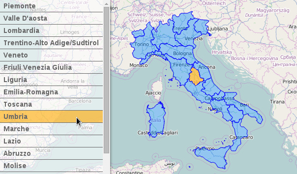
16 |
17 | #Where
18 |
19 | **Demo online:**
20 | [opengeo.tech/maps/leaflet-geojson-selector](https://opengeo.tech/maps/leaflet-geojson-selector/)
21 |
22 | **Source code:**
23 | [Github](https://github.com/stefanocudini/leaflet-geojson-selector)
24 | [NPM](https://npmjs.org/package/leaflet-geojson-selector)
25 |
26 |
27 | # Options
28 | | Option | Default | Description |
29 | | --------------------- | ----------------- | ----------------------------------------- |
30 | | collapsed | false | collapse panel list |
31 | | position | 'bottomleft' | position of panel list |
32 | | listLabel | 'properties.name' | GeoJSON property to generate items list |
33 | | listSortBy | 'properties.name' | property to sort items, default is listLabel |
34 | | listItemBuild | null | function list item builder |
35 | | activeListFromLayer | true | highlight of list item on layer hover |
36 | | zoomToLayer | false | |
37 | | listOnlyVisibleLayers | false | show only items visible in map canvas |
38 | | multiple | false | active multiple selection |
39 | | style | {} | style for GeoJSON features |
40 | | activeClass | 'active' | css class name for active list items |
41 | | activeStyle | | style for Active GeoJSON features |
42 | | selectClass | 'selected' | |
43 | | selectStyle | {} | style for Selected GeoJSON features |
44 |
45 | # Events
46 | | Event | Data | Description |
47 | | ---------------------- | ---------------------- | ----------------------------------------- |
48 | | 'selector:change' | {selected, layers} | fired after checked item in list, selected is true if any layer is selected |
49 |
50 | # Methods
51 | | Method | Arguments | Description |
52 | | ------------- | -------------- | ---------------------------- |
53 | | reload() | layer | search text by external code |
54 |
55 |
56 | #Build
57 |
58 | Since Version 1.4.7 this plugin support [Grunt](https://gruntjs.com/) for building process.
59 | Therefore the deployment require [NPM](https://npmjs.org/) installed in your system.
60 | After you've made sure to have npm working, run this in command line:
61 | ```bash
62 | npm install
63 | grunt
64 | ```
65 |
--------------------------------------------------------------------------------
/examples/italy-regions-centroids.json:
--------------------------------------------------------------------------------
1 | {
2 | "type": "FeatureCollection",
3 | "crs": { "type": "name", "properties": { "name": "urn:ogc:def:crs:OGC:1.3:CRS84" } },
4 |
5 | "features": [
6 | { "type": "Feature", "properties": { "id": 1, "name": "piemonte", "length": 1236869.3688, "area": 25394103941.599998474121094 }, "geometry": { "type": "Point", "coordinates": [ 7.9234934646534, 45.060434510910426 ] } },
7 | { "type": "Feature", "properties": { "id": 2, "name": "valle d'aosta", "length": 311165.134877, "area": 3259040961.300000190734863 }, "geometry": { "type": "Point", "coordinates": [ 7.387371468698934, 45.729793397029212 ] } },
8 | { "type": "Feature", "properties": { "id": 3, "name": "lombardia", "length": 1411265.07152, "area": 23862698613.599998474121094 }, "geometry": { "type": "Point", "coordinates": [ 9.76912494384448, 45.620526883113953 ] } },
9 | { "type": "Feature", "properties": { "id": 4, "name": "trentino-alto adige\/sudtirol", "length": 800534.132495, "area": 13608018378.5 }, "geometry": { "type": "Point", "coordinates": [ 11.281837212264195, 46.441293558688379 ] } },
10 | { "type": "Feature", "properties": { "id": 5, "name": "veneto", "length": 1057855.9676, "area": 18405499479.400001525878906 }, "geometry": { "type": "Point", "coordinates": [ 11.858635266169282, 45.65135430755187 ] } },
11 | { "type": "Feature", "properties": { "id": 6, "name": "friuli venezia giulia", "length": 667489.73706, "area": 7864293935.039999961853027 }, "geometry": { "type": "Point", "coordinates": [ 13.055599712004474, 46.151449369525295 ] } },
12 | { "type": "Feature", "properties": { "id": 7, "name": "liguria", "length": 834224.468035, "area": 5415464956.439999580383301 }, "geometry": { "type": "Point", "coordinates": [ 8.704347679144968, 44.264337389917159 ] } },
13 | { "type": "Feature", "properties": { "id": 8, "name": "emilia-romagna", "length": 1164723.05925, "area": 22451465521.900001525878906 }, "geometry": { "type": "Point", "coordinates": [ 11.038370070694492, 44.525671872112277 ] } },
14 | { "type": "Feature", "properties": { "id": 9, "name": "toscana", "length": 1316658.00191, "area": 22984426772.0 }, "geometry": { "type": "Point", "coordinates": [ 11.125968194206569, 43.450596410406227 ] } },
15 | { "type": "Feature", "properties": { "id": 10, "name": "umbria", "length": 620315.16993, "area": 8464007915.760000228881836 }, "geometry": { "type": "Point", "coordinates": [ 12.489918374340396, 42.965925326044136 ] } },
16 | { "type": "Feature", "properties": { "id": 11, "name": "marche", "length": 629209.047201, "area": 9401177971.950000762939453 }, "geometry": { "type": "Point", "coordinates": [ 13.137754205689735, 43.348191271410158 ] } },
17 | { "type": "Feature", "properties": { "id": 12, "name": "lazio", "length": 1055355.14651, "area": 17227617801.299999237060547 }, "geometry": { "type": "Point", "coordinates": [ 12.766418019625052, 41.979508132029359 ] } },
18 | { "type": "Feature", "properties": { "id": 13, "name": "abruzzo", "length": 614513.705789, "area": 10829102919.5 }, "geometry": { "type": "Point", "coordinates": [ 13.854750624992612, 42.227567318093691 ] } },
19 | { "type": "Feature", "properties": { "id": 14, "name": "molise", "length": 433874.67797, "area": 4461149496.359999656677246 }, "geometry": { "type": "Point", "coordinates": [ 14.59590002707427, 41.684336774322816 ] } },
20 | { "type": "Feature", "properties": { "id": 15, "name": "campania", "length": 892379.131913, "area": 13663989800.100000381469727 }, "geometry": { "type": "Point", "coordinates": [ 14.840184741519346, 40.859541713006756 ] } },
21 | { "type": "Feature", "properties": { "id": 16, "name": "puglia", "length": 1176242.99348, "area": 19537077223.0 }, "geometry": { "type": "Point", "coordinates": [ 16.620151828553368, 40.98457469614506 ] } },
22 | { "type": "Feature", "properties": { "id": 17, "name": "basilicata", "length": 614219.205497, "area": 10073260222.600000381469727 }, "geometry": { "type": "Point", "coordinates": [ 16.081513086108298, 40.499834506171283 ] } },
23 | { "type": "Feature", "properties": { "id": 18, "name": "calabria", "length": 838194.35773, "area": 15216683867.799999237060547 }, "geometry": { "type": "Point", "coordinates": [ 16.348024537585715, 39.068175002318881 ] } },
24 | { "type": "Feature", "properties": { "id": 19, "name": "sicilia", "length": 1339973.64188, "area": 25824775591.400001525878906 }, "geometry": { "type": "Point", "coordinates": [ 14.146974092654165, 37.588434530754036 ] } },
25 | { "type": "Feature", "properties": { "id": 20, "name": "sardegna", "length": 1460657.08082, "area": 24094165311.900001525878906 }, "geometry": { "type": "Point", "coordinates": [ 9.030305051968869, 40.08804809165639 ] } }
26 | ]
27 | }
28 |
--------------------------------------------------------------------------------
/dist/leaflet-geojson-selector.min.js:
--------------------------------------------------------------------------------
1 | /*
2 | * Leaflet GeoJSON Selector v0.5.4 - 2018-09-28
3 | *
4 | * Copyright 2018 Stefano Cudini
5 | * stefano.cudini@gmail.com
6 | * https://opengeo.tech/
7 | *
8 | * Licensed under the MIT license.
9 | *
10 | * Demo:
11 | * https://opengeo.tech/maps/leaflet-geojson-selector/
12 | *
13 | * Source:
14 | * git@github.com:stefanocudini/leaflet-geojson-selector.git
15 | *
16 | */
17 | !function(a){if("function"==typeof define&&define.amd)define(["leaflet"],a);else if("undefined"!=typeof module)module.exports=a(require("leaflet"));else{if("undefined"==typeof window.L)throw"Leaflet must be loaded first";a(window.L)}}(function(a){return a.Control.GeoJSONSelector=a.Control.extend({includes:"1"===a.version[0]?a.Evented.prototype:a.Mixin.Events,options:{position:"bottomleft",listLabel:"properties.name",listSortBy:null,listItemBuild:null,activeListFromLayer:!0,activeLayerFromList:!0,zoomToLayer:!1,listOnlyVisibleLayers:!1,multiple:!1,style:{color:"#00f",fillColor:"#08f",fillOpacity:.4,opacity:1,weight:1},activeClass:"active",activeStyle:{color:"#00f",fillColor:"#fc0",fillOpacity:.6,opacity:1,weight:1},selectClass:"selected",selectStyle:{color:"#00f",fillColor:"#f80",fillOpacity:.8,opacity:1,weight:1}},initialize:function(b,c){a.Util.setOptions(this,c||{});this.options.listSortBy=this.options.listSortBy||this.options.listLabel,this.options.listItemBuild&&(this._itemBuild=this.options.listItemBuild),this._layer=b},onAdd:function(b){var c=this;this._container=a.DomUtil.create("div","geojson-list"),this._baseName="geojson-list",this._map=b,this._id=this._baseName+a.stamp(this._container),this._list=a.DomUtil.create("ul","geojson-list-group",this._container),this._layer&&this._map.addLayer(this._layer),this._items=[],a.DomEvent.disableClickPropagation(this._container).disableScrollPropagation(this._container),this.options.listOnlyVisibleLayers&&b.on("moveend",this._updateVisible,this);var d=b.getSize();return c._container.style.height=d.y+"px",c._container.style.maxWidth=d.x/2+"px",c._update(),this._container},onRemove:function(a){a.off("moveend",this._updateVisible,this),this._layer.remove()},reload:function(a){return this._map&&(this._layer&&this._map.removeLayer(this._layer),this._map.addLayer(a),this._layer=a,this._update()),this},_getPath:function(a,b){var c=b.split("."),d=c.pop(),e=c.length,f=c[0],g=1;if(e>0)for(;(a=a[f])&&e>g;)f=c[g++];return a?a[d]:void 0},_itemBuild:function(a){return this._getPath(a.feature,this.options.listLabel)||" "},_selectItem:function(b,c){for(var d=0;de?-1:e>f?1:0});for(var d=0;d 0)
149 | while((obj = obj[cur]) && i < len)
150 | cur = parts[i++];
151 |
152 | if(obj)
153 | return obj[last];
154 | },
155 |
156 | _itemBuild: function(layer) {
157 |
158 | return this._getPath(layer.feature, this.options.listLabel) || ' ';
159 | },
160 |
161 | _selectItem: function(item, selected) {
162 |
163 | for (var i = 0; i < this._items.length; i++){
164 | delete this._items[i].selected;
165 | L.DomUtil.removeClass(this._items[i], this.options.selectClass);
166 | }
167 |
168 | if(selected){
169 | item.selected = selected;
170 | L.DomUtil.addClass(item, this.options.selectClass );
171 | }
172 | },
173 |
174 | _selectLayer: function(layer, selected) {
175 |
176 | for(var i = 0; i < this._items.length; i++)
177 | if(this._items[i].layer.setStyle)
178 | this._items[i].layer.setStyle( this.options.style );
179 |
180 | if(selected && layer.setStyle)
181 | layer.setStyle( this.options.selectStyle );
182 | },
183 |
184 | _createItem: function(layer) {
185 |
186 | var self = this,
187 | item = L.DomUtil.create('li','geojson-list-item'),
188 | label = document.createElement('label'),
189 | inputType = this.options.multiple ? 'checkbox' : 'radio',
190 | input = this._createInputElement(inputType, this._id, false),
191 | html = this._itemBuild.call(this, layer);
192 |
193 | label.innerHTML = html;
194 | label.insertBefore(input, label.firstChild);
195 | item.appendChild(label);
196 |
197 | //JOIN list and layers
198 | item.layer = layer;
199 | layer.itemList = item;
200 | layer.itemLabel = label;
201 |
202 | L.DomEvent
203 | //.disableClickPropagation(item)
204 | .on(label, 'click', L.DomEvent.stop, this)
205 | .on(label, 'click', function(e) {
206 |
207 | if(self.options.zoomToLayer) {
208 | self._moveTo(layer);
209 | }
210 |
211 | //TODO move in _moveTo callback
212 | input.checked = !input.checked;
213 |
214 | self._selectItem(item, input.checked);
215 | self._selectLayer(layer, input.checked);
216 |
217 | self.fire('selector:change', {
218 | selected: input.checked,
219 | layers: [layer]
220 | });
221 |
222 | }, this);
223 |
224 | L.DomEvent
225 | .on(item, 'mouseover', function(e) {
226 |
227 | L.DomUtil.addClass(e.target, this.options.activeClass);
228 |
229 | for (var i = 0; i < self._items.length; i++)
230 | if(!self._items[i])
231 | self._items[i].layer.setStyle( self.options.activeStyle );
232 |
233 | if(self.options.activeLayerFromList)
234 | item.layer.fire('mouseover');
235 |
236 | }, this)
237 | .on(item, 'mouseout', function(e) {
238 |
239 | L.DomUtil.removeClass(e.target, self.options.activeClass);
240 |
241 | for (var i = 0; i < self._items.length; i++)
242 | if(!self._items[i])
243 | self._items[i].layer.setStyle( self.options.style );
244 |
245 | if(self.options.activeLayerFromList)
246 | item.layer.fire('mouseout');
247 |
248 | }, this);
249 |
250 | this._items.push( item );
251 |
252 | return item;
253 | },
254 |
255 | // IE7 bugs out if you create a radio dynamically, so you have to do it this hacky way (see http://bit.ly/PqYLBe)
256 | _createInputElement: function (type, name, checked) {
257 |
258 | var radioHtml = ' bp)
316 | return 1;
317 | return 0;
318 | });
319 | }
320 |
321 | for(var i=0; i 0)
165 | while((obj = obj[cur]) && i < len)
166 | cur = parts[i++];
167 |
168 | if(obj)
169 | return obj[last];
170 | },
171 |
172 | _itemBuild: function(layer) {
173 |
174 | return this._getPath(layer.feature, this.options.listLabel) || ' ';
175 | },
176 |
177 | _selectItem: function(item, selected) {
178 |
179 | for (var i = 0; i < this._items.length; i++){
180 | delete this._items[i].selected;
181 | L.DomUtil.removeClass(this._items[i], this.options.selectClass);
182 | }
183 |
184 | if(selected){
185 | item.selected = selected;
186 | L.DomUtil.addClass(item, this.options.selectClass );
187 | }
188 | },
189 |
190 | _selectLayer: function(layer, selected) {
191 |
192 | for(var i = 0; i < this._items.length; i++)
193 | if(this._items[i].layer.setStyle)
194 | this._items[i].layer.setStyle( this.options.style );
195 |
196 | if(selected && layer.setStyle)
197 | layer.setStyle( this.options.selectStyle );
198 | },
199 |
200 | _createItem: function(layer) {
201 |
202 | var self = this,
203 | item = L.DomUtil.create('li','geojson-list-item'),
204 | label = document.createElement('label'),
205 | inputType = this.options.multiple ? 'checkbox' : 'radio',
206 | input = this._createInputElement(inputType, this._id, false),
207 | html = this._itemBuild.call(this, layer);
208 |
209 | label.innerHTML = html;
210 | label.insertBefore(input, label.firstChild);
211 | item.appendChild(label);
212 |
213 | //JOIN list and layers
214 | item.layer = layer;
215 | layer.itemList = item;
216 | layer.itemLabel = label;
217 |
218 | L.DomEvent
219 | //.disableClickPropagation(item)
220 | .on(label, 'click', L.DomEvent.stop, this)
221 | .on(label, 'click', function(e) {
222 |
223 | if(self.options.zoomToLayer) {
224 | self._moveTo(layer);
225 | }
226 |
227 | //TODO move in _moveTo callback
228 | input.checked = !input.checked;
229 |
230 | self._selectItem(item, input.checked);
231 | self._selectLayer(layer, input.checked);
232 |
233 | self.fire('selector:change', {
234 | selected: input.checked,
235 | layers: [layer]
236 | });
237 |
238 | }, this);
239 |
240 | L.DomEvent
241 | .on(item, 'mouseover', function(e) {
242 |
243 | L.DomUtil.addClass(e.target, this.options.activeClass);
244 |
245 | for (var i = 0; i < self._items.length; i++)
246 | if(!self._items[i])
247 | self._items[i].layer.setStyle( self.options.activeStyle );
248 |
249 | if(self.options.activeLayerFromList)
250 | item.layer.fire('mouseover');
251 |
252 | }, this)
253 | .on(item, 'mouseout', function(e) {
254 |
255 | L.DomUtil.removeClass(e.target, self.options.activeClass);
256 |
257 | for (var i = 0; i < self._items.length; i++)
258 | if(!self._items[i])
259 | self._items[i].layer.setStyle( self.options.style );
260 |
261 | if(self.options.activeLayerFromList)
262 | item.layer.fire('mouseout');
263 |
264 | }, this);
265 |
266 | this._items.push( item );
267 |
268 | return item;
269 | },
270 |
271 | // IE7 bugs out if you create a radio dynamically, so you have to do it this hacky way (see https://bit.ly/PqYLBe)
272 | _createInputElement: function (type, name, checked) {
273 |
274 | var radioHtml = ' bp)
332 | return 1;
333 | return 0;
334 | });
335 | }
336 |
337 | for(var i=0; i
2 |
3 |
4 |
381 |
--------------------------------------------------------------------------------