├── .gitignore
├── .npmignore
├── LICENSE
├── README.md
├── img
├── counties.png
├── nation.png
└── states.png
├── package.json
├── prepublish
├── properties.js
└── yarn.lock
/.gitignore:
--------------------------------------------------------------------------------
1 | *.sublime-workspace
2 | .DS_Store
3 | build/
4 | node_modules
5 | npm-debug.log
6 | *-10m.json
7 |
--------------------------------------------------------------------------------
/.npmignore:
--------------------------------------------------------------------------------
1 | *.sublime-*
2 | build/
3 | test/
4 | img/
5 |
--------------------------------------------------------------------------------
/LICENSE:
--------------------------------------------------------------------------------
1 | Copyright 2013-2019 Michael Bostock
2 |
3 | Permission to use, copy, modify, and/or distribute this software for any purpose
4 | with or without fee is hereby granted, provided that the above copyright notice
5 | and this permission notice appear in all copies.
6 |
7 | THE SOFTWARE IS PROVIDED "AS IS" AND THE AUTHOR DISCLAIMS ALL WARRANTIES WITH
8 | REGARD TO THIS SOFTWARE INCLUDING ALL IMPLIED WARRANTIES OF MERCHANTABILITY AND
9 | FITNESS. IN NO EVENT SHALL THE AUTHOR BE LIABLE FOR ANY SPECIAL, DIRECT,
10 | INDIRECT, OR CONSEQUENTIAL DAMAGES OR ANY DAMAGES WHATSOEVER RESULTING FROM LOSS
11 | OF USE, DATA OR PROFITS, WHETHER IN AN ACTION OF CONTRACT, NEGLIGENCE OR OTHER
12 | TORTIOUS ACTION, ARISING OUT OF OR IN CONNECTION WITH THE USE OR PERFORMANCE OF
13 | THIS SOFTWARE.
14 |
--------------------------------------------------------------------------------
/README.md:
--------------------------------------------------------------------------------
1 | # U.S. Atlas TopoJSON
2 |
3 | This repository provides a convenient redistribution of the [Census Bureau’s](http://www.census.gov/) [cartographic boundary shapefiles](https://www.census.gov/geographies/mapping-files/time-series/geo/carto-boundary-file.html), 2017 edition as TopoJSON. For earlier editions, see [past releases](https://github.com/topojson/us-atlas/releases). Both projected and unprojected geometries are included. The projection used by these files is:
4 |
5 | ```js
6 | d3.geoAlbersUsa().scale(1300).translate([487.5, 305])
7 | ````
8 |
9 | This is a conic equal-area Albers projection suitable for choropleth maps and designed to fit a 975×610 viewport.
10 |
11 | ### Usage
12 |
13 | In a browser, using [d3-geo](https://github.com/d3/d3-geo) and SVG:
14 | https://observablehq.com/@d3/u-s-map
15 |
16 | In a browser, using [d3-geo](https://github.com/d3/d3-geo) and Canvas:
17 | https://observablehq.com/@d3/u-s-map-canvas
18 |
19 | In Node, using [d3-geo](https://github.com/d3/d3-geo) and [node-canvas](https://github.com/Automattic/node-canvas):
20 | https://bl.ocks.org/mbostock/885fffe88d72b2a25c090e0bbbef382f
21 |
22 | ## File Reference
23 |
24 | # counties-10m.json · [Download](https://cdn.jsdelivr.net/npm/us-atlas@3/counties-10m.json "Source")
25 |
26 | A [TopoJSON file](https://github.com/topojson/topojson-specification/blob/master/README.md#21-topology-objects) containing the geometry collections counties, states, and nation. The geometry is quantized and simplified, but not projected. This topology is derived from the Census Bureau’s [cartographic county boundaries, 2017 edition](https://www2.census.gov/geo/tiger/GENZ2017/shp/). The state boundaries are computed by [merging](https://github.com/topojson/topojson-client/blob/master/README.md#merge) counties, and the nation boundary is computed by merging states, ensuring a consistent topology.
27 |
28 | # counties-albers-10m.json · [Download](https://cdn.jsdelivr.net/npm/us-atlas@3/counties-albers-10m.json "Source")
29 |
30 | A [TopoJSON file](https://github.com/topojson/topojson-specification/blob/master/README.md#21-topology-objects) containing the geometry collections counties, states, and nation. The geometry is quantized, projected using [d3.geoAlbersUsa](https://github.com/d3/d3-geo/blob/master/README.md#geoAlbersUsa) to fit a 975×610 viewport, and simplified. This topology is derived from the Census Bureau’s [cartographic county boundaries, 2017 edition](https://www2.census.gov/geo/tiger/GENZ2017/shp/). The state boundaries are computed by [merging](https://github.com/topojson/topojson-client/blob/master/README.md#merge) counties, and the nation boundary is computed by merging states, ensuring a consistent topology.
31 |
32 | # states-10m.json · [Download](https://cdn.jsdelivr.net/npm/us-atlas@3/states-10m.json "Source")
33 |
34 | A [TopoJSON file](https://github.com/topojson/topojson-specification/blob/master/README.md#21-topology-objects) containing the geometry collections states and nation. The geometry is quantized and simplified, but not projected. This topology is derived from the Census Bureau’s [cartographic state boundaries, 2017 edition](https://www2.census.gov/geo/tiger/GENZ2017/shp/). The nation boundary is computed by [merging](https://github.com/topojson/topojson-client/blob/master/README.md#merge) states, ensuring a consistent topology.
35 |
36 | # states-albers-10m.json · [Download](https://cdn.jsdelivr.net/npm/us-atlas@3/states-albers-10m.json "Source")
37 |
38 | A [TopoJSON file](https://github.com/topojson/topojson-specification/blob/master/README.md#21-topology-objects) containing the geometry collections states and nation. The geometry is quantized, projected using [d3.geoAlbersUsa](https://github.com/d3/d3-geo/blob/master/README.md#geoAlbersUsa) to fit a 975×610 viewport, and simplified. This topology is derived from the Census Bureau’s [cartographic state boundaries, 2017 edition](https://www2.census.gov/geo/tiger/GENZ2017/shp/). The nation boundary is computed by [merging](https://github.com/topojson/topojson-client/blob/master/README.md#merge) states, ensuring a consistent topology.
39 |
40 | # nation-10m.json · [Download](https://cdn.jsdelivr.net/npm/us-atlas@3/nation-10m.json "Source")
41 |
42 | A [TopoJSON file](https://github.com/topojson/topojson-specification/blob/master/README.md#21-topology-objects) containing the geometry collection nation. The geometry is quantized and simplified, but not projected. This topology is derived from the Census Bureau’s [cartographic nation boundary, 2017 edition](https://www2.census.gov/geo/tiger/GENZ2017/shp/).
43 |
44 | # nation-albers-10m.json · [Download](https://cdn.jsdelivr.net/npm/us-atlas@3/nation-albers-10m.json "Source")
45 |
46 | A [TopoJSON file](https://github.com/topojson/topojson-specification/blob/master/README.md#21-topology-objects) containing the geometry collection nation. The geometry is quantized, projected using [d3.geoAlbersUsa](https://github.com/d3/d3-geo/blob/master/README.md#geoAlbersUsa) to fit a 975×610 viewport, and simplified. This topology is derived from the Census Bureau’s [cartographic nation boundary, 2017 edition](https://www2.census.gov/geo/tiger/GENZ2017/shp/).
47 |
48 | # *us*.objects.counties
49 |
50 |  51 |
52 | Each county has two fields:
53 |
54 | * *county*.id - the five-digit [FIPS county code](https://en.wikipedia.org/wiki/FIPS_county_code), such as `"06069"`
55 | * *county*.properties.name - the county name, such as `"San Benito"`
56 |
57 | The first two digits of the county FIPS code is the state FIPS code.
58 |
59 | # *us*.objects.states
60 |
61 |
51 |
52 | Each county has two fields:
53 |
54 | * *county*.id - the five-digit [FIPS county code](https://en.wikipedia.org/wiki/FIPS_county_code), such as `"06069"`
55 | * *county*.properties.name - the county name, such as `"San Benito"`
56 |
57 | The first two digits of the county FIPS code is the state FIPS code.
58 |
59 | # *us*.objects.states
60 |
61 | 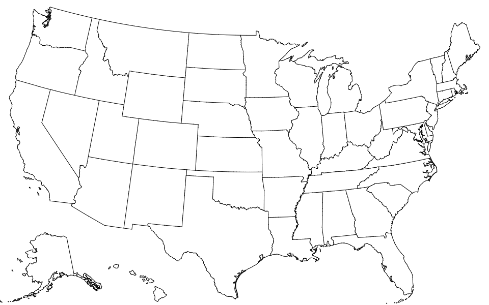 62 |
63 | Each state has two fields:
64 |
65 | * *state*.id - the two-digit [FIPS state code](https://en.wikipedia.org/wiki/Federal_Information_Processing_Standard_state_code), such as `"06"`
66 | * *state*.properties.name - the state name, such as `"California"`
67 |
68 | # *us*.objects.nation
69 |
70 |
62 |
63 | Each state has two fields:
64 |
65 | * *state*.id - the two-digit [FIPS state code](https://en.wikipedia.org/wiki/Federal_Information_Processing_Standard_state_code), such as `"06"`
66 | * *state*.properties.name - the state name, such as `"California"`
67 |
68 | # *us*.objects.nation
69 |
70 | 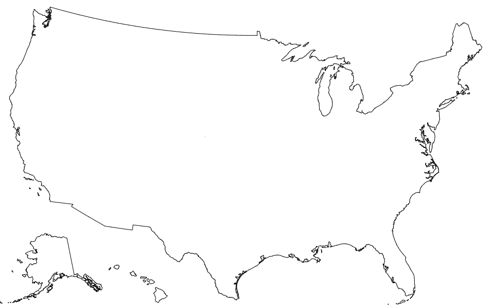 71 |
72 | The nation has two fields:
73 |
74 | * *nation*.id - the string `"US"`
75 | * *nation*.properties.name - the string `"United States"`
76 |
--------------------------------------------------------------------------------
/img/counties.png:
--------------------------------------------------------------------------------
https://raw.githubusercontent.com/topojson/us-atlas/d6968f52f5418bc71afc64e034cbfdba8d898de4/img/counties.png
--------------------------------------------------------------------------------
/img/nation.png:
--------------------------------------------------------------------------------
https://raw.githubusercontent.com/topojson/us-atlas/d6968f52f5418bc71afc64e034cbfdba8d898de4/img/nation.png
--------------------------------------------------------------------------------
/img/states.png:
--------------------------------------------------------------------------------
https://raw.githubusercontent.com/topojson/us-atlas/d6968f52f5418bc71afc64e034cbfdba8d898de4/img/states.png
--------------------------------------------------------------------------------
/package.json:
--------------------------------------------------------------------------------
1 | {
2 | "name": "us-atlas",
3 | "version": "3.0.1",
4 | "description": "Pre-built TopoJSON from the U.S. Census Bureau.",
5 | "license": "ISC",
6 | "keywords": [
7 | "topojson",
8 | "geojson",
9 | "shapefile"
10 | ],
11 | "author": {
12 | "name": "Mike Bostock",
13 | "url": "https://bost.ocks.org/mike"
14 | },
15 | "repository": {
16 | "type": "git",
17 | "url": "https://github.com/topojson/us-atlas.git"
18 | },
19 | "files": [
20 | "*-10m.json"
21 | ],
22 | "scripts": {
23 | "prepublishOnly": "bash prepublish",
24 | "postpublish": "git push && git push --tags"
25 | },
26 | "devDependencies": {
27 | "d3-dsv": "^1.0.3",
28 | "d3-geo-projection": "^2.0.0",
29 | "ndjson-cli": "^0.3.0",
30 | "shapefile": "^0.6.1",
31 | "topojson-client": "^3.0.0",
32 | "topojson-server": "^3.0.0",
33 | "topojson-simplify": "^3.0.0"
34 | }
35 | }
36 |
--------------------------------------------------------------------------------
/prepublish:
--------------------------------------------------------------------------------
1 | #!/bin/bash
2 |
3 | rm -rvf *-10m.json
4 | mkdir -p build
5 |
6 | if [ ! -f build/cb_2017_us_county_5m.shp ]; then
7 | curl -o build/cb_2017_us_county_5m.zip 'https://www2.census.gov/geo/tiger/GENZ2017/shp/cb_2017_us_county_5m.zip'
8 | unzip -od build build/cb_2017_us_county_5m.zip cb_2017_us_county_5m.shp cb_2017_us_county_5m.dbf
9 | chmod a-x build/cb_2017_us_county_5m.*
10 | fi
11 |
12 | if [ ! -f build/cb_2017_us_state_5m.shp ]; then
13 | curl -o build/cb_2017_us_state_5m.zip 'https://www2.census.gov/geo/tiger/GENZ2017/shp/cb_2017_us_state_5m.zip'
14 | unzip -od build build/cb_2017_us_state_5m.zip cb_2017_us_state_5m.shp cb_2017_us_state_5m.dbf
15 | chmod a-x build/cb_2017_us_state_5m.*
16 | fi
17 |
18 | if [ ! -f build/cb_2017_us_nation_5m.shp ]; then
19 | curl -o build/cb_2017_us_nation_5m.zip 'https://www2.census.gov/geo/tiger/GENZ2017/shp/cb_2017_us_nation_5m.zip'
20 | unzip -od build build/cb_2017_us_nation_5m.zip cb_2017_us_nation_5m.shp cb_2017_us_nation_5m.dbf
21 | chmod a-x build/cb_2017_us_nation_5m.*
22 | fi
23 |
24 | geo2topo -q 1e5 -n counties=<( \
25 | shp2json --encoding utf-8 -n build/cb_2017_us_county_5m.shp \
26 | | ndjson-filter '!/000$/.test(d.properties.GEOID)' \
27 | | ndjson-map '(d.id = d.properties.GEOID, delete d.properties, d)') \
28 | | toposimplify -f -s 1e-7 \
29 | | topomerge states=counties -k 'd.id.slice(0, 2)' \
30 | | topomerge nation=states \
31 | | node ./properties.js \
32 | > counties-10m.json
33 |
34 | geo2topo -q 1e5 -n counties=<( \
35 | shp2json --encoding utf-8 -n build/cb_2017_us_county_5m.shp \
36 | | ndjson-filter '!/000$/.test(d.properties.GEOID)' \
37 | | ndjson-map '(d.id = d.properties.GEOID, delete d.properties, d)' \
38 | | geoproject -n 'd3.geoAlbersUsa().scale(1300).translate([487.5, 305])') \
39 | | toposimplify -f -p 0.25 \
40 | | topomerge states=counties -k 'd.id.slice(0, 2)' \
41 | | topomerge nation=states \
42 | | node ./properties.js \
43 | > counties-albers-10m.json
44 |
45 | geo2topo -q 1e5 -n states=<( \
46 | shp2json --encoding utf-8 -n build/cb_2017_us_state_5m.shp \
47 | | ndjson-filter '!/000$/.test(d.properties.GEOID)' \
48 | | ndjson-map '(d.id = d.properties.GEOID, d.properties = {name: d.properties.NAME}, d)') \
49 | | toposimplify -f -s 1e-7 \
50 | | topomerge nation=states \
51 | > states-10m.json
52 |
53 | geo2topo -q 1e5 -n states=<( \
54 | shp2json --encoding utf-8 -n build/cb_2017_us_state_5m.shp \
55 | | ndjson-filter '!/000$/.test(d.properties.GEOID)' \
56 | | ndjson-map '(d.id = d.properties.GEOID, d.properties = {name: d.properties.NAME}, d)' \
57 | | geoproject -n 'd3.geoAlbersUsa().scale(1300).translate([487.5, 305])') \
58 | | toposimplify -f -p 0.25 \
59 | | topomerge nation=states \
60 | > states-albers-10m.json
61 |
62 | geo2topo -q 1e5 -n nation=<( \
63 | shp2json --encoding utf-8 -n build/cb_2017_us_nation_5m.shp \
64 | | ndjson-filter '!/000$/.test(d.properties.GEOID)' \
65 | | ndjson-map '(d.id = d.properties.GEOID, d.properties = {name: d.properties.NAME}, d)') \
66 | | toposimplify -f -s 1e-7 \
67 | > nation-10m.json
68 |
69 | geo2topo -q 1e5 -n nation=<( \
70 | shp2json --encoding utf-8 -n build/cb_2017_us_nation_5m.shp \
71 | | ndjson-filter '!/000$/.test(d.properties.GEOID)' \
72 | | ndjson-map '(d.id = d.properties.GEOID, d.properties = {name: d.properties.NAME}, d)' \
73 | | geoproject -n 'd3.geoAlbersUsa().scale(1300).translate([487.5, 305])') \
74 | | toposimplify -f -p 0.25 \
75 | > nation-albers-10m.json
76 |
--------------------------------------------------------------------------------
/properties.js:
--------------------------------------------------------------------------------
1 | const shapefile = require("shapefile");
2 |
3 | Promise.all([
4 | parseInput(),
5 | shapefile.read("build/cb_2017_us_county_5m.shp", undefined, {encoding: "utf-8"}),
6 | shapefile.read("build/cb_2017_us_state_5m.shp", undefined, {encoding: "utf-8"})
7 | ]).then(output);
8 |
9 | function parseInput() {
10 | return new Promise((resolve, reject) => {
11 | const chunks = [];
12 | process.stdin
13 | .on("data", chunk => chunks.push(chunk))
14 | .on("end", () => {
15 | try { resolve(JSON.parse(chunks.join(""))); }
16 | catch (error) { reject(error); }
17 | })
18 | .setEncoding("utf8");
19 | });
20 | }
21 |
22 | function output([topology, counties, states]) {
23 | counties = new Map(counties.features.map(d => [d.properties.GEOID, d.properties]));
24 | states = new Map(states.features.map(d => [d.properties.GEOID, d.properties]));
25 | for (const county of topology.objects.counties.geometries) {
26 | county.properties = {
27 | name: counties.get(county.id).NAME
28 | };
29 | }
30 | for (const state of topology.objects.states.geometries) {
31 | state.properties = {
32 | name: states.get(state.id).NAME
33 | };
34 | }
35 | process.stdout.write(JSON.stringify(topology));
36 | process.stdout.write("\n");
37 | }
38 |
--------------------------------------------------------------------------------
/yarn.lock:
--------------------------------------------------------------------------------
1 | # THIS IS AN AUTOGENERATED FILE. DO NOT EDIT THIS FILE DIRECTLY.
2 | # yarn lockfile v1
3 |
4 |
5 | acorn@^5.1.1:
6 | version "5.7.3"
7 | resolved "https://registry.yarnpkg.com/acorn/-/acorn-5.7.3.tgz#67aa231bf8812974b85235a96771eb6bd07ea279"
8 | integrity sha512-T/zvzYRfbVojPWahDsE5evJdHb3oJoQfFbsrKM7w5Zcs++Tr257tia3BmMP8XYVjp1S9RZXQMh7gao96BlqZOw==
9 |
10 | array-source@0.0:
11 | version "0.0.4"
12 | resolved "https://registry.yarnpkg.com/array-source/-/array-source-0.0.4.tgz#a525df4a84b1376d27c677cd426a97c3882f8aca"
13 | integrity sha512-frNdc+zBn80vipY+GdcJkLEbMWj3xmzArYApmUGxoiV8uAu/ygcs9icPdsGdA26h0MkHUMW6EN2piIvVx+M5Mw==
14 |
15 | commander@2, commander@^2.11.0:
16 | version "2.20.0"
17 | resolved "https://registry.yarnpkg.com/commander/-/commander-2.20.0.tgz#d58bb2b5c1ee8f87b0d340027e9e94e222c5a422"
18 | integrity sha512-7j2y+40w61zy6YC2iRNpUe/NwhNyoXrYpHMrSunaMG64nRnaf96zO/KMQR4OyN/UnE5KLyEBnKHd4aG3rskjpQ==
19 |
20 | d3-array@1:
21 | version "1.2.4"
22 | resolved "https://registry.yarnpkg.com/d3-array/-/d3-array-1.2.4.tgz#635ce4d5eea759f6f605863dbcfc30edc737f71f"
23 | integrity sha512-KHW6M86R+FUPYGb3R5XiYjXPq7VzwxZ22buHhAEVG5ztoEcZZMLov530mmccaqA1GghZArjQV46fuc8kUqhhHw==
24 |
25 | d3-dsv@^1.0.3:
26 | version "1.1.1"
27 | resolved "https://registry.yarnpkg.com/d3-dsv/-/d3-dsv-1.1.1.tgz#aaa830ecb76c4b5015572c647cc6441e3c7bb701"
28 | integrity sha512-1EH1oRGSkeDUlDRbhsFytAXU6cAmXFzc52YUe6MRlPClmWb85MP1J5x+YJRzya4ynZWnbELdSAvATFW/MbxaXw==
29 | dependencies:
30 | commander "2"
31 | iconv-lite "0.4"
32 | rw "1"
33 |
34 | d3-geo-projection@^2.0.0:
35 | version "2.7.0"
36 | resolved "https://registry.yarnpkg.com/d3-geo-projection/-/d3-geo-projection-2.7.0.tgz#a881871004a892f51424ca649b09977b1dbd5ee6"
37 | integrity sha512-G8C/8gvUQVwuLloW88d/NGbyh5CLONowQzU6gB7cczfGbSjMrQHFbaCqipWUqUWaBdqpyfTlLE3GPGy0RMpKYw==
38 | dependencies:
39 | commander "2"
40 | d3-array "1"
41 | d3-geo "^1.10.0"
42 | resolve "^1.1.10"
43 |
44 | d3-geo@^1.10.0:
45 | version "1.11.6"
46 | resolved "https://registry.yarnpkg.com/d3-geo/-/d3-geo-1.11.6.tgz#134f2ef035ff75a448075fafdea92702a2e0e0cf"
47 | integrity sha512-z0J8InXR9e9wcgNtmVnPTj0TU8nhYT6lD/ak9may2PdKqXIeHUr8UbFLoCtrPYNsjv6YaLvSDQVl578k6nm7GA==
48 | dependencies:
49 | d3-array "1"
50 |
51 | file-source@0.6:
52 | version "0.6.1"
53 | resolved "https://registry.yarnpkg.com/file-source/-/file-source-0.6.1.tgz#ae189d4993766b865a77f83adcf9b9a504cd37dc"
54 | integrity sha1-rhidSZN2a4Zad/g63Pm5pQTNN9w=
55 | dependencies:
56 | stream-source "0.3"
57 |
58 | iconv-lite@0.4:
59 | version "0.4.24"
60 | resolved "https://registry.yarnpkg.com/iconv-lite/-/iconv-lite-0.4.24.tgz#2022b4b25fbddc21d2f524974a474aafe733908b"
61 | integrity sha512-v3MXnZAcvnywkTUEZomIActle7RXXeedOR31wwl7VlyoXO4Qi9arvSenNQWne1TcRwhCL1HwLI21bEqdpj8/rA==
62 | dependencies:
63 | safer-buffer ">= 2.1.2 < 3"
64 |
65 | ndjson-cli@^0.3.0:
66 | version "0.3.1"
67 | resolved "https://registry.yarnpkg.com/ndjson-cli/-/ndjson-cli-0.3.1.tgz#aa98e1a1cc98e524ca37a7bdc03a2ae26f88e140"
68 | integrity sha512-WMt3oFipPwmVvuFY2IwSNx+IeeRxZkc3OZEKTugk/FTmBRWcapH9PjtxU3Wap4CPcZ94a3nCnjEX8Ny/SrlZtA==
69 | dependencies:
70 | acorn "^5.1.1"
71 | commander "^2.11.0"
72 | resolve "^1.3.3"
73 |
74 | path-parse@^1.0.6:
75 | version "1.0.6"
76 | resolved "https://registry.yarnpkg.com/path-parse/-/path-parse-1.0.6.tgz#d62dbb5679405d72c4737ec58600e9ddcf06d24c"
77 | integrity sha512-GSmOT2EbHrINBf9SR7CDELwlJ8AENk3Qn7OikK4nFYAu3Ote2+JYNVvkpAEQm3/TLNEJFD/xZJjzyxg3KBWOzw==
78 |
79 | path-source@0.1:
80 | version "0.1.3"
81 | resolved "https://registry.yarnpkg.com/path-source/-/path-source-0.1.3.tgz#03907c595480aa2596a15a901c44f745736e7a73"
82 | integrity sha512-dWRHm5mIw5kw0cs3QZLNmpUWty48f5+5v9nWD2dw3Y0Hf+s01Ag8iJEWV0Sm0kocE8kK27DrIowha03e1YR+Qw==
83 | dependencies:
84 | array-source "0.0"
85 | file-source "0.6"
86 |
87 | resolve@^1.1.10, resolve@^1.3.3:
88 | version "1.12.0"
89 | resolved "https://registry.yarnpkg.com/resolve/-/resolve-1.12.0.tgz#3fc644a35c84a48554609ff26ec52b66fa577df6"
90 | integrity sha512-B/dOmuoAik5bKcD6s6nXDCjzUKnaDvdkRyAk6rsmsKLipWj4797iothd7jmmUhWTfinVMU+wc56rYKsit2Qy4w==
91 | dependencies:
92 | path-parse "^1.0.6"
93 |
94 | rw@1:
95 | version "1.3.3"
96 | resolved "https://registry.yarnpkg.com/rw/-/rw-1.3.3.tgz#3f862dfa91ab766b14885ef4d01124bfda074fb4"
97 | integrity sha1-P4Yt+pGrdmsUiF700BEkv9oHT7Q=
98 |
99 | "safer-buffer@>= 2.1.2 < 3":
100 | version "2.1.2"
101 | resolved "https://registry.yarnpkg.com/safer-buffer/-/safer-buffer-2.1.2.tgz#44fa161b0187b9549dd84bb91802f9bd8385cd6a"
102 | integrity sha512-YZo3K82SD7Riyi0E1EQPojLz7kpepnSQI9IyPbHHg1XXXevb5dJI7tpyN2ADxGcQbHG7vcyRHk0cbwqcQriUtg==
103 |
104 | shapefile@^0.6.1:
105 | version "0.6.6"
106 | resolved "https://registry.yarnpkg.com/shapefile/-/shapefile-0.6.6.tgz#6fee152b9fb2b1c85f690285b692fb68c95a5f4f"
107 | integrity sha512-rLGSWeK2ufzCVx05wYd+xrWnOOdSV7xNUW5/XFgx3Bc02hBkpMlrd2F1dDII7/jhWzv0MSyBFh5uJIy9hLdfuw==
108 | dependencies:
109 | array-source "0.0"
110 | commander "2"
111 | path-source "0.1"
112 | slice-source "0.4"
113 | stream-source "0.3"
114 | text-encoding "^0.6.4"
115 |
116 | slice-source@0.4:
117 | version "0.4.1"
118 | resolved "https://registry.yarnpkg.com/slice-source/-/slice-source-0.4.1.tgz#40a57ac03c6668b5da200e05378e000bf2a61d79"
119 | integrity sha1-QKV6wDxmaLXaIA4FN44AC/KmHXk=
120 |
121 | stream-source@0.3:
122 | version "0.3.5"
123 | resolved "https://registry.yarnpkg.com/stream-source/-/stream-source-0.3.5.tgz#b97f52d0f8ea566db071db679b985403a31e0340"
124 | integrity sha512-ZuEDP9sgjiAwUVoDModftG0JtYiLUV8K4ljYD1VyUMRWtbVf92474o4kuuul43iZ8t/hRuiDAx1dIJSvirrK/g==
125 |
126 | text-encoding@^0.6.4:
127 | version "0.6.4"
128 | resolved "https://registry.yarnpkg.com/text-encoding/-/text-encoding-0.6.4.tgz#e399a982257a276dae428bb92845cb71bdc26d19"
129 | integrity sha1-45mpgiV6J22uQou5KEXLcb3CbRk=
130 |
131 | topojson-client@3, topojson-client@^3.0.0:
132 | version "3.0.0"
133 | resolved "https://registry.yarnpkg.com/topojson-client/-/topojson-client-3.0.0.tgz#1f99293a77ef42a448d032a81aa982b73f360d2f"
134 | integrity sha1-H5kpOnfvQqRI0DKoGqmCtz82DS8=
135 | dependencies:
136 | commander "2"
137 |
138 | topojson-server@^3.0.0:
139 | version "3.0.0"
140 | resolved "https://registry.yarnpkg.com/topojson-server/-/topojson-server-3.0.0.tgz#378e78e87c3972a7b5be2c5d604369b6bae69c5e"
141 | integrity sha1-N4546Hw5cqe1vixdYENptrrmnF4=
142 | dependencies:
143 | commander "2"
144 |
145 | topojson-simplify@^3.0.0:
146 | version "3.0.2"
147 | resolved "https://registry.yarnpkg.com/topojson-simplify/-/topojson-simplify-3.0.2.tgz#8a2403e639531500fafa0c6594e8b0fadebc2c02"
148 | integrity sha512-gyYSVRt4jO/0RJXKZQPzTDQRWV+D/nOfiljNUv0HBXslFLtq3yxRHrl7jbrjdbda5Ytdr7M8BZUI4OxU7tnbRQ==
149 | dependencies:
150 | commander "2"
151 | topojson-client "3"
152 |
--------------------------------------------------------------------------------
71 |
72 | The nation has two fields:
73 |
74 | * *nation*.id - the string `"US"`
75 | * *nation*.properties.name - the string `"United States"`
76 |
--------------------------------------------------------------------------------
/img/counties.png:
--------------------------------------------------------------------------------
https://raw.githubusercontent.com/topojson/us-atlas/d6968f52f5418bc71afc64e034cbfdba8d898de4/img/counties.png
--------------------------------------------------------------------------------
/img/nation.png:
--------------------------------------------------------------------------------
https://raw.githubusercontent.com/topojson/us-atlas/d6968f52f5418bc71afc64e034cbfdba8d898de4/img/nation.png
--------------------------------------------------------------------------------
/img/states.png:
--------------------------------------------------------------------------------
https://raw.githubusercontent.com/topojson/us-atlas/d6968f52f5418bc71afc64e034cbfdba8d898de4/img/states.png
--------------------------------------------------------------------------------
/package.json:
--------------------------------------------------------------------------------
1 | {
2 | "name": "us-atlas",
3 | "version": "3.0.1",
4 | "description": "Pre-built TopoJSON from the U.S. Census Bureau.",
5 | "license": "ISC",
6 | "keywords": [
7 | "topojson",
8 | "geojson",
9 | "shapefile"
10 | ],
11 | "author": {
12 | "name": "Mike Bostock",
13 | "url": "https://bost.ocks.org/mike"
14 | },
15 | "repository": {
16 | "type": "git",
17 | "url": "https://github.com/topojson/us-atlas.git"
18 | },
19 | "files": [
20 | "*-10m.json"
21 | ],
22 | "scripts": {
23 | "prepublishOnly": "bash prepublish",
24 | "postpublish": "git push && git push --tags"
25 | },
26 | "devDependencies": {
27 | "d3-dsv": "^1.0.3",
28 | "d3-geo-projection": "^2.0.0",
29 | "ndjson-cli": "^0.3.0",
30 | "shapefile": "^0.6.1",
31 | "topojson-client": "^3.0.0",
32 | "topojson-server": "^3.0.0",
33 | "topojson-simplify": "^3.0.0"
34 | }
35 | }
36 |
--------------------------------------------------------------------------------
/prepublish:
--------------------------------------------------------------------------------
1 | #!/bin/bash
2 |
3 | rm -rvf *-10m.json
4 | mkdir -p build
5 |
6 | if [ ! -f build/cb_2017_us_county_5m.shp ]; then
7 | curl -o build/cb_2017_us_county_5m.zip 'https://www2.census.gov/geo/tiger/GENZ2017/shp/cb_2017_us_county_5m.zip'
8 | unzip -od build build/cb_2017_us_county_5m.zip cb_2017_us_county_5m.shp cb_2017_us_county_5m.dbf
9 | chmod a-x build/cb_2017_us_county_5m.*
10 | fi
11 |
12 | if [ ! -f build/cb_2017_us_state_5m.shp ]; then
13 | curl -o build/cb_2017_us_state_5m.zip 'https://www2.census.gov/geo/tiger/GENZ2017/shp/cb_2017_us_state_5m.zip'
14 | unzip -od build build/cb_2017_us_state_5m.zip cb_2017_us_state_5m.shp cb_2017_us_state_5m.dbf
15 | chmod a-x build/cb_2017_us_state_5m.*
16 | fi
17 |
18 | if [ ! -f build/cb_2017_us_nation_5m.shp ]; then
19 | curl -o build/cb_2017_us_nation_5m.zip 'https://www2.census.gov/geo/tiger/GENZ2017/shp/cb_2017_us_nation_5m.zip'
20 | unzip -od build build/cb_2017_us_nation_5m.zip cb_2017_us_nation_5m.shp cb_2017_us_nation_5m.dbf
21 | chmod a-x build/cb_2017_us_nation_5m.*
22 | fi
23 |
24 | geo2topo -q 1e5 -n counties=<( \
25 | shp2json --encoding utf-8 -n build/cb_2017_us_county_5m.shp \
26 | | ndjson-filter '!/000$/.test(d.properties.GEOID)' \
27 | | ndjson-map '(d.id = d.properties.GEOID, delete d.properties, d)') \
28 | | toposimplify -f -s 1e-7 \
29 | | topomerge states=counties -k 'd.id.slice(0, 2)' \
30 | | topomerge nation=states \
31 | | node ./properties.js \
32 | > counties-10m.json
33 |
34 | geo2topo -q 1e5 -n counties=<( \
35 | shp2json --encoding utf-8 -n build/cb_2017_us_county_5m.shp \
36 | | ndjson-filter '!/000$/.test(d.properties.GEOID)' \
37 | | ndjson-map '(d.id = d.properties.GEOID, delete d.properties, d)' \
38 | | geoproject -n 'd3.geoAlbersUsa().scale(1300).translate([487.5, 305])') \
39 | | toposimplify -f -p 0.25 \
40 | | topomerge states=counties -k 'd.id.slice(0, 2)' \
41 | | topomerge nation=states \
42 | | node ./properties.js \
43 | > counties-albers-10m.json
44 |
45 | geo2topo -q 1e5 -n states=<( \
46 | shp2json --encoding utf-8 -n build/cb_2017_us_state_5m.shp \
47 | | ndjson-filter '!/000$/.test(d.properties.GEOID)' \
48 | | ndjson-map '(d.id = d.properties.GEOID, d.properties = {name: d.properties.NAME}, d)') \
49 | | toposimplify -f -s 1e-7 \
50 | | topomerge nation=states \
51 | > states-10m.json
52 |
53 | geo2topo -q 1e5 -n states=<( \
54 | shp2json --encoding utf-8 -n build/cb_2017_us_state_5m.shp \
55 | | ndjson-filter '!/000$/.test(d.properties.GEOID)' \
56 | | ndjson-map '(d.id = d.properties.GEOID, d.properties = {name: d.properties.NAME}, d)' \
57 | | geoproject -n 'd3.geoAlbersUsa().scale(1300).translate([487.5, 305])') \
58 | | toposimplify -f -p 0.25 \
59 | | topomerge nation=states \
60 | > states-albers-10m.json
61 |
62 | geo2topo -q 1e5 -n nation=<( \
63 | shp2json --encoding utf-8 -n build/cb_2017_us_nation_5m.shp \
64 | | ndjson-filter '!/000$/.test(d.properties.GEOID)' \
65 | | ndjson-map '(d.id = d.properties.GEOID, d.properties = {name: d.properties.NAME}, d)') \
66 | | toposimplify -f -s 1e-7 \
67 | > nation-10m.json
68 |
69 | geo2topo -q 1e5 -n nation=<( \
70 | shp2json --encoding utf-8 -n build/cb_2017_us_nation_5m.shp \
71 | | ndjson-filter '!/000$/.test(d.properties.GEOID)' \
72 | | ndjson-map '(d.id = d.properties.GEOID, d.properties = {name: d.properties.NAME}, d)' \
73 | | geoproject -n 'd3.geoAlbersUsa().scale(1300).translate([487.5, 305])') \
74 | | toposimplify -f -p 0.25 \
75 | > nation-albers-10m.json
76 |
--------------------------------------------------------------------------------
/properties.js:
--------------------------------------------------------------------------------
1 | const shapefile = require("shapefile");
2 |
3 | Promise.all([
4 | parseInput(),
5 | shapefile.read("build/cb_2017_us_county_5m.shp", undefined, {encoding: "utf-8"}),
6 | shapefile.read("build/cb_2017_us_state_5m.shp", undefined, {encoding: "utf-8"})
7 | ]).then(output);
8 |
9 | function parseInput() {
10 | return new Promise((resolve, reject) => {
11 | const chunks = [];
12 | process.stdin
13 | .on("data", chunk => chunks.push(chunk))
14 | .on("end", () => {
15 | try { resolve(JSON.parse(chunks.join(""))); }
16 | catch (error) { reject(error); }
17 | })
18 | .setEncoding("utf8");
19 | });
20 | }
21 |
22 | function output([topology, counties, states]) {
23 | counties = new Map(counties.features.map(d => [d.properties.GEOID, d.properties]));
24 | states = new Map(states.features.map(d => [d.properties.GEOID, d.properties]));
25 | for (const county of topology.objects.counties.geometries) {
26 | county.properties = {
27 | name: counties.get(county.id).NAME
28 | };
29 | }
30 | for (const state of topology.objects.states.geometries) {
31 | state.properties = {
32 | name: states.get(state.id).NAME
33 | };
34 | }
35 | process.stdout.write(JSON.stringify(topology));
36 | process.stdout.write("\n");
37 | }
38 |
--------------------------------------------------------------------------------
/yarn.lock:
--------------------------------------------------------------------------------
1 | # THIS IS AN AUTOGENERATED FILE. DO NOT EDIT THIS FILE DIRECTLY.
2 | # yarn lockfile v1
3 |
4 |
5 | acorn@^5.1.1:
6 | version "5.7.3"
7 | resolved "https://registry.yarnpkg.com/acorn/-/acorn-5.7.3.tgz#67aa231bf8812974b85235a96771eb6bd07ea279"
8 | integrity sha512-T/zvzYRfbVojPWahDsE5evJdHb3oJoQfFbsrKM7w5Zcs++Tr257tia3BmMP8XYVjp1S9RZXQMh7gao96BlqZOw==
9 |
10 | array-source@0.0:
11 | version "0.0.4"
12 | resolved "https://registry.yarnpkg.com/array-source/-/array-source-0.0.4.tgz#a525df4a84b1376d27c677cd426a97c3882f8aca"
13 | integrity sha512-frNdc+zBn80vipY+GdcJkLEbMWj3xmzArYApmUGxoiV8uAu/ygcs9icPdsGdA26h0MkHUMW6EN2piIvVx+M5Mw==
14 |
15 | commander@2, commander@^2.11.0:
16 | version "2.20.0"
17 | resolved "https://registry.yarnpkg.com/commander/-/commander-2.20.0.tgz#d58bb2b5c1ee8f87b0d340027e9e94e222c5a422"
18 | integrity sha512-7j2y+40w61zy6YC2iRNpUe/NwhNyoXrYpHMrSunaMG64nRnaf96zO/KMQR4OyN/UnE5KLyEBnKHd4aG3rskjpQ==
19 |
20 | d3-array@1:
21 | version "1.2.4"
22 | resolved "https://registry.yarnpkg.com/d3-array/-/d3-array-1.2.4.tgz#635ce4d5eea759f6f605863dbcfc30edc737f71f"
23 | integrity sha512-KHW6M86R+FUPYGb3R5XiYjXPq7VzwxZ22buHhAEVG5ztoEcZZMLov530mmccaqA1GghZArjQV46fuc8kUqhhHw==
24 |
25 | d3-dsv@^1.0.3:
26 | version "1.1.1"
27 | resolved "https://registry.yarnpkg.com/d3-dsv/-/d3-dsv-1.1.1.tgz#aaa830ecb76c4b5015572c647cc6441e3c7bb701"
28 | integrity sha512-1EH1oRGSkeDUlDRbhsFytAXU6cAmXFzc52YUe6MRlPClmWb85MP1J5x+YJRzya4ynZWnbELdSAvATFW/MbxaXw==
29 | dependencies:
30 | commander "2"
31 | iconv-lite "0.4"
32 | rw "1"
33 |
34 | d3-geo-projection@^2.0.0:
35 | version "2.7.0"
36 | resolved "https://registry.yarnpkg.com/d3-geo-projection/-/d3-geo-projection-2.7.0.tgz#a881871004a892f51424ca649b09977b1dbd5ee6"
37 | integrity sha512-G8C/8gvUQVwuLloW88d/NGbyh5CLONowQzU6gB7cczfGbSjMrQHFbaCqipWUqUWaBdqpyfTlLE3GPGy0RMpKYw==
38 | dependencies:
39 | commander "2"
40 | d3-array "1"
41 | d3-geo "^1.10.0"
42 | resolve "^1.1.10"
43 |
44 | d3-geo@^1.10.0:
45 | version "1.11.6"
46 | resolved "https://registry.yarnpkg.com/d3-geo/-/d3-geo-1.11.6.tgz#134f2ef035ff75a448075fafdea92702a2e0e0cf"
47 | integrity sha512-z0J8InXR9e9wcgNtmVnPTj0TU8nhYT6lD/ak9may2PdKqXIeHUr8UbFLoCtrPYNsjv6YaLvSDQVl578k6nm7GA==
48 | dependencies:
49 | d3-array "1"
50 |
51 | file-source@0.6:
52 | version "0.6.1"
53 | resolved "https://registry.yarnpkg.com/file-source/-/file-source-0.6.1.tgz#ae189d4993766b865a77f83adcf9b9a504cd37dc"
54 | integrity sha1-rhidSZN2a4Zad/g63Pm5pQTNN9w=
55 | dependencies:
56 | stream-source "0.3"
57 |
58 | iconv-lite@0.4:
59 | version "0.4.24"
60 | resolved "https://registry.yarnpkg.com/iconv-lite/-/iconv-lite-0.4.24.tgz#2022b4b25fbddc21d2f524974a474aafe733908b"
61 | integrity sha512-v3MXnZAcvnywkTUEZomIActle7RXXeedOR31wwl7VlyoXO4Qi9arvSenNQWne1TcRwhCL1HwLI21bEqdpj8/rA==
62 | dependencies:
63 | safer-buffer ">= 2.1.2 < 3"
64 |
65 | ndjson-cli@^0.3.0:
66 | version "0.3.1"
67 | resolved "https://registry.yarnpkg.com/ndjson-cli/-/ndjson-cli-0.3.1.tgz#aa98e1a1cc98e524ca37a7bdc03a2ae26f88e140"
68 | integrity sha512-WMt3oFipPwmVvuFY2IwSNx+IeeRxZkc3OZEKTugk/FTmBRWcapH9PjtxU3Wap4CPcZ94a3nCnjEX8Ny/SrlZtA==
69 | dependencies:
70 | acorn "^5.1.1"
71 | commander "^2.11.0"
72 | resolve "^1.3.3"
73 |
74 | path-parse@^1.0.6:
75 | version "1.0.6"
76 | resolved "https://registry.yarnpkg.com/path-parse/-/path-parse-1.0.6.tgz#d62dbb5679405d72c4737ec58600e9ddcf06d24c"
77 | integrity sha512-GSmOT2EbHrINBf9SR7CDELwlJ8AENk3Qn7OikK4nFYAu3Ote2+JYNVvkpAEQm3/TLNEJFD/xZJjzyxg3KBWOzw==
78 |
79 | path-source@0.1:
80 | version "0.1.3"
81 | resolved "https://registry.yarnpkg.com/path-source/-/path-source-0.1.3.tgz#03907c595480aa2596a15a901c44f745736e7a73"
82 | integrity sha512-dWRHm5mIw5kw0cs3QZLNmpUWty48f5+5v9nWD2dw3Y0Hf+s01Ag8iJEWV0Sm0kocE8kK27DrIowha03e1YR+Qw==
83 | dependencies:
84 | array-source "0.0"
85 | file-source "0.6"
86 |
87 | resolve@^1.1.10, resolve@^1.3.3:
88 | version "1.12.0"
89 | resolved "https://registry.yarnpkg.com/resolve/-/resolve-1.12.0.tgz#3fc644a35c84a48554609ff26ec52b66fa577df6"
90 | integrity sha512-B/dOmuoAik5bKcD6s6nXDCjzUKnaDvdkRyAk6rsmsKLipWj4797iothd7jmmUhWTfinVMU+wc56rYKsit2Qy4w==
91 | dependencies:
92 | path-parse "^1.0.6"
93 |
94 | rw@1:
95 | version "1.3.3"
96 | resolved "https://registry.yarnpkg.com/rw/-/rw-1.3.3.tgz#3f862dfa91ab766b14885ef4d01124bfda074fb4"
97 | integrity sha1-P4Yt+pGrdmsUiF700BEkv9oHT7Q=
98 |
99 | "safer-buffer@>= 2.1.2 < 3":
100 | version "2.1.2"
101 | resolved "https://registry.yarnpkg.com/safer-buffer/-/safer-buffer-2.1.2.tgz#44fa161b0187b9549dd84bb91802f9bd8385cd6a"
102 | integrity sha512-YZo3K82SD7Riyi0E1EQPojLz7kpepnSQI9IyPbHHg1XXXevb5dJI7tpyN2ADxGcQbHG7vcyRHk0cbwqcQriUtg==
103 |
104 | shapefile@^0.6.1:
105 | version "0.6.6"
106 | resolved "https://registry.yarnpkg.com/shapefile/-/shapefile-0.6.6.tgz#6fee152b9fb2b1c85f690285b692fb68c95a5f4f"
107 | integrity sha512-rLGSWeK2ufzCVx05wYd+xrWnOOdSV7xNUW5/XFgx3Bc02hBkpMlrd2F1dDII7/jhWzv0MSyBFh5uJIy9hLdfuw==
108 | dependencies:
109 | array-source "0.0"
110 | commander "2"
111 | path-source "0.1"
112 | slice-source "0.4"
113 | stream-source "0.3"
114 | text-encoding "^0.6.4"
115 |
116 | slice-source@0.4:
117 | version "0.4.1"
118 | resolved "https://registry.yarnpkg.com/slice-source/-/slice-source-0.4.1.tgz#40a57ac03c6668b5da200e05378e000bf2a61d79"
119 | integrity sha1-QKV6wDxmaLXaIA4FN44AC/KmHXk=
120 |
121 | stream-source@0.3:
122 | version "0.3.5"
123 | resolved "https://registry.yarnpkg.com/stream-source/-/stream-source-0.3.5.tgz#b97f52d0f8ea566db071db679b985403a31e0340"
124 | integrity sha512-ZuEDP9sgjiAwUVoDModftG0JtYiLUV8K4ljYD1VyUMRWtbVf92474o4kuuul43iZ8t/hRuiDAx1dIJSvirrK/g==
125 |
126 | text-encoding@^0.6.4:
127 | version "0.6.4"
128 | resolved "https://registry.yarnpkg.com/text-encoding/-/text-encoding-0.6.4.tgz#e399a982257a276dae428bb92845cb71bdc26d19"
129 | integrity sha1-45mpgiV6J22uQou5KEXLcb3CbRk=
130 |
131 | topojson-client@3, topojson-client@^3.0.0:
132 | version "3.0.0"
133 | resolved "https://registry.yarnpkg.com/topojson-client/-/topojson-client-3.0.0.tgz#1f99293a77ef42a448d032a81aa982b73f360d2f"
134 | integrity sha1-H5kpOnfvQqRI0DKoGqmCtz82DS8=
135 | dependencies:
136 | commander "2"
137 |
138 | topojson-server@^3.0.0:
139 | version "3.0.0"
140 | resolved "https://registry.yarnpkg.com/topojson-server/-/topojson-server-3.0.0.tgz#378e78e87c3972a7b5be2c5d604369b6bae69c5e"
141 | integrity sha1-N4546Hw5cqe1vixdYENptrrmnF4=
142 | dependencies:
143 | commander "2"
144 |
145 | topojson-simplify@^3.0.0:
146 | version "3.0.2"
147 | resolved "https://registry.yarnpkg.com/topojson-simplify/-/topojson-simplify-3.0.2.tgz#8a2403e639531500fafa0c6594e8b0fadebc2c02"
148 | integrity sha512-gyYSVRt4jO/0RJXKZQPzTDQRWV+D/nOfiljNUv0HBXslFLtq3yxRHrl7jbrjdbda5Ytdr7M8BZUI4OxU7tnbRQ==
149 | dependencies:
150 | commander "2"
151 | topojson-client "3"
152 |
--------------------------------------------------------------------------------